
IMAGES TAKEN NEAR TO
Peregrine Drive, BENFLEET, SS7 5EJ
Introduction
This page details the photographs taken nearby to Peregrine Drive, SS7 5EJ by members of the Geograph project.
The Geograph project started in 2005 with the aim of publishing, organising and preserving representative images for every square kilometre of Great Britain, Ireland and the Isle of Man.

There are currently over 7.5m images from over14,400 individuals and you can help contribute to the project by visiting https://www.geograph.org.uk
Image Map
Images are licensed for reuse under creativecommons.org/licenses/by-sa/2.0
Notes
- Clicking on the map will re-center to the selected point.
- The higher the marker number, the further away the image location is from the centre of the postcode.
Image Listing (14 Images Found)
Images are licensed for reuse under creativecommons.org/licenses/by-sa/2.0
Image
Details
Distance
1
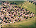
Aerial view of the 'Bird' estate, Benfleet
This estate is the south-eastern corner of the Hopes Green estate, and gets its name from the street names which are mostly named after birds. The road winding upwards from the bottom left is Woodham Park Drive, but other roads are named Dove, Linnet, Raven, Swallow, Kingfisher, Curlew and Peregrine. The green area to the bottom and right is part of the Hopes Green recreation ground.
Image: © Edward Clack
Taken: 17 Jun 1987
0.07 miles
2
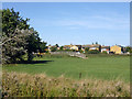
Footbridge, South Benfleet Playing Fields
Linking one field with another.
Image: © Robin Webster
Taken: 11 Sep 2016
0.13 miles
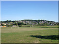
4
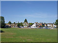
Playing field off Woodham Park Drive
The west end of several fields, collectively known as South Benfleet Playing Fields.
Image: © Robin Webster
Taken: 11 Sep 2016
0.17 miles
5
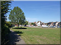
Playing field off Woodham Park Drive
The west end of several fields, collectively known as South Benfleet Playing Fields.
Image: © Robin Webster
Taken: 11 Sep 2016
0.17 miles
6
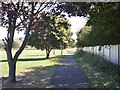
Footpath by railway, South Benfleet
Along the edge of playing fields, with the railway beyond the fence on the right.
Image: © Robin Webster
Taken: 11 Sep 2016
0.18 miles
7

Footpath, Benfleet Marsh
Running from the old part of South Benfleet to points west.
Image: © Robin Webster
Taken: 11 Sep 2016
0.19 miles
8
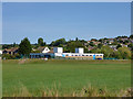
Pavilion, South Benfleet Playing Fields
At the end of Brook Road.
Image: © Robin Webster
Taken: 11 Sep 2016
0.20 miles
10
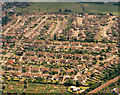
Aerial view of the Hopes Green estate, Benfleet
This photo shows almost all of the Hopes Green estate, apart from the northernmost third, and the south-west corner known as the 'Bird' estate Image In the foreground are allotments. In the background, the green is part of the Hopes Green recreation ground. The railway, from Southend and Benfleet to Fenchurch Street is visible in the bottom left corner.
Image: © Edward Clack
Taken: 17 Jun 1987
0.21 miles