IMAGES TAKEN NEAR TO
Woodside Avenue, BENFLEET, SS7 4NY
Introduction
This page details the photographs taken nearby to Woodside Avenue, SS7 4NY by members of the Geograph project.
The Geograph project started in 2005 with the aim of publishing, organising and preserving representative images for every square kilometre of Great Britain, Ireland and the Isle of Man.

There are currently over 7.5m images from over14,400 individuals and you can help contribute to the project by visiting https://www.geograph.org.uk
Image Map
Images are licensed for reuse under creativecommons.org/licenses/by-sa/2.0
Notes
- Clicking on the map will re-center to the selected point.
- The higher the marker number, the further away the image location is from the centre of the postcode.
Image Listing (17 Images Found)
Images are licensed for reuse under creativecommons.org/licenses/by-sa/2.0
Image
Details
Distance
2
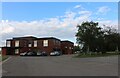
Sports pavilion on Manor Road, Thundersley
Image: © David Howard
Taken: 25 May 2021
0.08 miles
3
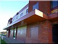
Woodside Park Sports Pavilion
It was all boarded up and graffiti-ised when I was eating my chips there.
It's near Tarpots.
Image: © Julieanne Savage
Taken: 20 Jan 2007
0.11 miles

5
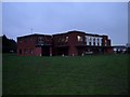
Woodside Park Sports Pavilion, New Thundersley
This sports pavilion serves a sizable recreation ground in New Thundersley.
Image: © Glyn Baker
Taken: 15 Jan 2006
0.11 miles
8
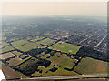
Aerial view of Woodside cemetery and New Thundersley
The crematorium and cemetery buildings lie almost dead centre. The cemetery lies to the left of these in the photo, as a rectangular plot within a rectangular field. To the right of these buildings is a car park and the Woodside Sports Centre, with the playing fields below. Above the cemetery is the Manor Trading Estate. The road at the bottom is the A130 to Canvey Island.
Image: © Edward Clack
Taken: 3 Aug 1987
0.15 miles
9
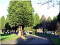
Woodside Cemetery
Off Manor Road, New Thundersley.
Image: © Julieanne Savage
Taken: 20 Jan 2007
0.17 miles