IMAGES TAKEN NEAR TO
Abbotswood, BENFLEET, SS7 3XT
Introduction
This page details the photographs taken nearby to Abbotswood, SS7 3XT by members of the Geograph project.
The Geograph project started in 2005 with the aim of publishing, organising and preserving representative images for every square kilometre of Great Britain, Ireland and the Isle of Man.

There are currently over 7.5m images from over14,400 individuals and you can help contribute to the project by visiting https://www.geograph.org.uk
Image Map
Images are licensed for reuse under creativecommons.org/licenses/by-sa/2.0
Notes
- Clicking on the map will re-center to the selected point.
- The higher the marker number, the further away the image location is from the centre of the postcode.
Image Listing (19 Images Found)
Images are licensed for reuse under creativecommons.org/licenses/by-sa/2.0
Image
Details
Distance
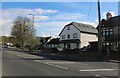
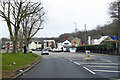
1
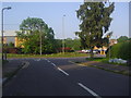
Kingsmere at the junction of Rayleigh Road
Image: © David Howard
Taken: 24 May 2012
0.08 miles
2
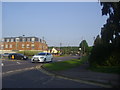
Rayleigh Road at the corner of Kingsmere
Image: © David Howard
Taken: 24 May 2012
0.09 miles
3
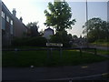
Kingsmere at the junction of Rayleigh Road
Image: © David Howard
Taken: 24 May 2012
0.09 miles
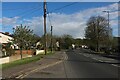
4
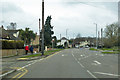
A129 Rayleigh Road
Heading towards Rayleigh.
Image: © Robin Webster
Taken: 25 Mar 2018
0.10 miles
7
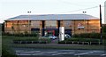
Leisure Centre
Virgin Leisure Centre, Rayleigh Road, Hadleigh.
Image: © Paul Collins
Taken: 24 Jul 2007
0.14 miles
8
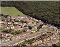
Aerial view of Rayleigh Road and West Wood, Thundersley
The Rayleigh Road (A129) runs left-to-right across the picture. The small close above this is Prittle Close. The two roads at the bottom right are from the right) Parkfields and Drake Close. West Wood occupies the top right of the picture. The playing fields in the upper left are those of The Deanes School.
Image: © Edward Clack
Taken: 11 Sep 1987
0.15 miles
9
A129 Rayleigh Road
Heading towards Rayleigh.
Image: © Robin Webster
Taken: 25 Mar 2018
0.18 miles
10
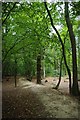
Path in West Wood
This path runs along an extensive earthwork http://www.castlepoint.gov.uk/main.cfm?type=3337
Image: © Glyn Baker
Taken: 25 Sep 2010
0.18 miles