
IMAGES TAKEN NEAR TO
Napier Gardens, BENFLEET, SS7 3UZ
Introduction
This page details the photographs taken nearby to Napier Gardens, SS7 3UZ by members of the Geograph project.
The Geograph project started in 2005 with the aim of publishing, organising and preserving representative images for every square kilometre of Great Britain, Ireland and the Isle of Man.

There are currently over 7.5m images from over14,400 individuals and you can help contribute to the project by visiting https://www.geograph.org.uk
Image Map
Images are licensed for reuse under creativecommons.org/licenses/by-sa/2.0
Notes
- Clicking on the map will re-center to the selected point.
- The higher the marker number, the further away the image location is from the centre of the postcode.
Image Listing (10 Images Found)
Images are licensed for reuse under creativecommons.org/licenses/by-sa/2.0
Image
Details
Distance
1
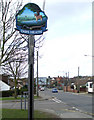
Daws Heath Sign
The sign is located on Daws Heath Road at the junction of Tollgate.
Image: © terry joyce
Taken: 4 Mar 2010
0.05 miles
4
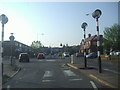
The junction of Rayleigh Road and Hart Road
Image: © David Howard
Taken: 24 May 2012
0.13 miles
5
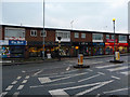
Shops on Rayleigh Road
A row of local shops on the A129 in Thundersley.
Image: © John Allan
Taken: 13 Feb 2012
0.16 miles
6
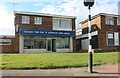
Ocean fish bar on Hart Road, Thundersley
Image: © David Howard
Taken: 25 May 2021
0.17 miles
8
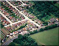
Aerial view of the eastern end of The Chase, Thundersley
The Chase runs from the top left diagonally down to just right of centre. The road running from the lower left to the middle right is the Rayleigh Road (A129). The minor road parallel and to the right of The Chase is Martingale. The two small roads at right angle to The Chase are Corasway on the left and The Canters on the right.
Image: © Edward Clack
Taken: 10 Jul 1988
0.24 miles
9
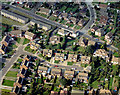
Aerial view of Meadow Close and part of Common Lane, Thundersley
Common Lane runs from the top left down to the centre right. Meadow Close is the cul-de-sac just below the centre. The road in the lower left is Woodlow and that in the upper right is Keysland. The area is typical suburbia.
Image: © Edward Clack
Taken: 18 Sep 1987
0.24 miles
10
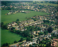
Aerial view of the Rayleigh Road with Daws Heath beyond
The Rayleigh Road (A129) runs across the lower right of the picture. The minor road at the centre is Asquith Gardens. Beyond this, the housing at the upper right lies along Daws Heath Road. Most of the pasture seen here is for horse grazing.
Image: © Edward Clack
Taken: 13 Jun 1988
0.24 miles