
IMAGES TAKEN NEAR TO
Kenneth Road, BENFLEET, SS7 3AW
Introduction
This page details the photographs taken nearby to Kenneth Road, SS7 3AW by members of the Geograph project.
The Geograph project started in 2005 with the aim of publishing, organising and preserving representative images for every square kilometre of Great Britain, Ireland and the Isle of Man.

There are currently over 7.5m images from over14,400 individuals and you can help contribute to the project by visiting https://www.geograph.org.uk
Image Map
Images are licensed for reuse under creativecommons.org/licenses/by-sa/2.0
Notes
- Clicking on the map will re-center to the selected point.
- The higher the marker number, the further away the image location is from the centre of the postcode.
Image Listing (14 Images Found)
Images are licensed for reuse under creativecommons.org/licenses/by-sa/2.0
Image
Details
Distance
1
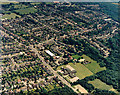
Aerial view of Kingston School and southern Thundersley
This view is almost of the same area as Image, but from the opposite direction. Kingston Primary School lies lower-centre, with the Church Road to its left. The white-roofed building just below-left of centre is the postal sorting office. The wood to the right is Coombe Wood. For other roads and buildings see Image
Image: © Edward Clack
Taken: 1 Jul 1987
0.11 miles
2
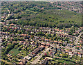
Aerial view of Kenneth Road and Coombe Wood, Benfleet
Kenneth Road runs from the centre-left to the lower right. The road running to the lower centre is The Chase. The road above and parallel to Kenneth Road is Thundersley Grove. Coombe Wood lies above this.
Image: © Edward Clack
Taken: 8 May 1987
0.13 miles
3
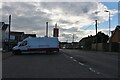
Parking area on Church Road, Thundersley
The post office is on the left.
Image: © David Howard
Taken: 25 May 2021
0.13 miles
4
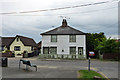
Cottages, Hart Road, Thundersley
One of the few older buildings in this area. Grade II listed, 18th/19th century.
Image: © Robin Webster
Taken: 28 May 2017
0.13 miles
7
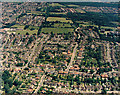
Aerial view of Kenneth Road and southern Thundersley
Kenneth Road runs from left to right in the lower third. Below and right of this is Thundersley Grove. The three roads above Kenneth Road are (from the left) Kings Park, The Chase and Dorothy Gardens. The buildings and fields just above centre -left are Thundersley Infants and Junior School (commonly known as Dark Lane School).
Image: © Edward Clack
Taken: 1 Jul 1987
0.17 miles
8
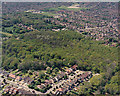
Aerial view of Coombe Wood, Benfleet
Coombe Wood is an area of ancient and secondary woodland lying north of the A13 in Benfleet. The A13 (London Road) is just visible running from just above centre-left, then slightly upwards to the right. The woodland just above-left of centre is elevated and forms a small hilltop within the wood. There is an underlying cap of Bagshot sands rather than the Claygate beds underlying other parts. The area to the upper left of this hill (south of the A13) comprises plotland. The roads in the lower left are Thundersley Grove (lower left) and Coombewood Drive (lower centre).
Image: © Edward Clack
Taken: 8 May 1987
0.20 miles
9
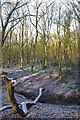
A Coombe Wood Stream
A fallen tree over a stream in Coombe Wood, this area of Thundersley Woods managed by Castlepoint Council was granted “Village Green” status in 2007.
Image: © Glyn Baker
Taken: 1 Jan 2010
0.21 miles
10
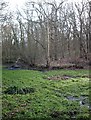
The pond - Coombe Wood, Thundersley
Now reverting to swamp at its western end, this largish pond was formed by damming a scarp spring in this very steep-sided wood north of the A13 on Bread and Cheese Hill.
Image: © John Myers
Taken: 4 Feb 2007
0.22 miles