
IMAGES TAKEN NEAR TO
Kenneth Road, BENFLEET, SS7 3AL
Introduction
This page details the photographs taken nearby to Kenneth Road, SS7 3AL by members of the Geograph project.
The Geograph project started in 2005 with the aim of publishing, organising and preserving representative images for every square kilometre of Great Britain, Ireland and the Isle of Man.

There are currently over 7.5m images from over14,400 individuals and you can help contribute to the project by visiting https://www.geograph.org.uk
Image Map
Images are licensed for reuse under creativecommons.org/licenses/by-sa/2.0
Notes
- Clicking on the map will re-center to the selected point.
- The higher the marker number, the further away the image location is from the centre of the postcode.
Image Listing (20 Images Found)
Images are licensed for reuse under creativecommons.org/licenses/by-sa/2.0
Image
Details
Distance
3
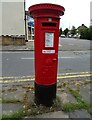
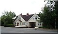
George V postbox on Bartley Road
Postbox No. SS7 233.
Image: © JThomas
Taken: 23 Aug 2022
0.08 miles
6
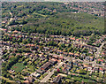
Aerial view of Kenneth Road and Coombe Wood, Benfleet
Kenneth Road runs from the centre-left to the lower right. The road running to the lower centre is The Chase. The road above and parallel to Kenneth Road is Thundersley Grove. Coombe Wood lies above this.
Image: © Edward Clack
Taken: 8 May 1987
0.11 miles
8
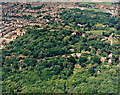
Aerial view of woodland west of Thundersley Glen, Benfleet
This shows the woodland either side of Mount Road, an unmade road south of the A13 or London Road (which lies just off the photo, to the right). Much of the woodland in the centre of the photo is managed as a private nature reserve. These woodlands lie on higher ground, which slopes towards the lower ground to the top of the photo.
Image: © Edward Clack
Taken: Unknown
0.12 miles
9
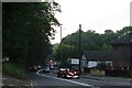
Show Off on Bread & Cheese Hill
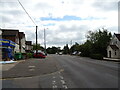
This is a view of the A13 Bread & Cheese Hill Thundersley. The hill rises 54m from the 30m contour line at TQ775844 to the 84m Spot Height at TQ788879 (about 1.5km in road distance). That's a long hill in Essex!. The hill got its name in the Edwardian era when motorcars on the way to Southend-on-Sea would boil over by the time they reached the brow of the hill. Chauffeurs would eat their bread and cheese lunch while the engines cooled. It was not long before a hostelry (which still survives) was opened to take advantage of the trade. There are no prizes for guessing its name!
Image: © Glyn Baker
Taken: 15 Oct 2005
0.15 miles
10
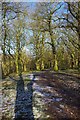
Path Through Thundersley Glen
Thundersley Glen is part of Thundersley Woods Managed by Castlepoint Council see http://www.castlepoint.gov.uk/main.cfm?Type=3339
Image: © Glyn Baker
Taken: 1 Jan 2010
0.16 miles