IMAGES TAKEN NEAR TO
The Poppies, BENFLEET, SS7 1FJ
Introduction
This page details the photographs taken nearby to The Poppies, SS7 1FJ by members of the Geograph project.
The Geograph project started in 2005 with the aim of publishing, organising and preserving representative images for every square kilometre of Great Britain, Ireland and the Isle of Man.

There are currently over 7.5m images from over14,400 individuals and you can help contribute to the project by visiting https://www.geograph.org.uk
Image Map
Images are licensed for reuse under creativecommons.org/licenses/by-sa/2.0
Notes
- Clicking on the map will re-center to the selected point.
- The higher the marker number, the further away the image location is from the centre of the postcode.
Image Listing (10 Images Found)
Images are licensed for reuse under creativecommons.org/licenses/by-sa/2.0
Image
Details
Distance
1
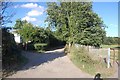
The Chase
The Chase is an unmade road in Thundersley.
Image: © Trevor Harris
Taken: 1 Aug 2008
0.13 miles
2
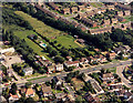
Aerial view of Kiln Road and Shipwrights Drive junction, Thundersley
Kiln Road runs across the bottom, with Shipwrights Drive joining it at the right. The land to the right, above the white house were then (1987) a nursery. This land, and the green area in the centre, is currently the subject of a planning application for 150 new houses. This, unsurprisingly, has been the subject of considerable local opposition.
Image: © Edward Clack
Taken: 3 Aug 1987
0.17 miles
3
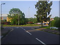
Kingsmere at the junction of Rayleigh Road
Image: © David Howard
Taken: 24 May 2012
0.17 miles
4
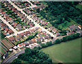
Aerial view of the eastern end of The Chase, Thundersley
The Chase runs from the top left diagonally down to just right of centre. The road running from the lower left to the middle right is the Rayleigh Road (A129). The minor road parallel and to the right of The Chase is Martingale. The two small roads at right angle to The Chase are Corasway on the left and The Canters on the right.
Image: © Edward Clack
Taken: 10 Jul 1988
0.17 miles
5
Kingsmere at the junction of Rayleigh Road
Image: © David Howard
Taken: 24 May 2012
0.19 miles
6
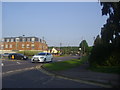
Rayleigh Road at the corner of Kingsmere
Image: © David Howard
Taken: 24 May 2012
0.19 miles
7
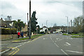
A129 Rayleigh Road
Heading towards Rayleigh.
Image: © Robin Webster
Taken: 25 Mar 2018
0.20 miles
8
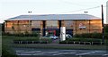
Leisure Centre
Virgin Leisure Centre, Rayleigh Road, Hadleigh.
Image: © Paul Collins
Taken: 24 Jul 2007
0.24 miles