
IMAGES TAKEN NEAR TO
Clifton Avenue, BENFLEET, SS7 1DQ
Introduction
This page details the photographs taken nearby to Clifton Avenue, SS7 1DQ by members of the Geograph project.
The Geograph project started in 2005 with the aim of publishing, organising and preserving representative images for every square kilometre of Great Britain, Ireland and the Isle of Man.

There are currently over 7.5m images from over14,400 individuals and you can help contribute to the project by visiting https://www.geograph.org.uk
Image Map
Images are licensed for reuse under creativecommons.org/licenses/by-sa/2.0
Notes
- Clicking on the map will re-center to the selected point.
- The higher the marker number, the further away the image location is from the centre of the postcode.
Image Listing (4 Images Found)
Images are licensed for reuse under creativecommons.org/licenses/by-sa/2.0
Image
Details
Distance
1
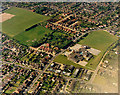
Kents Hill Primary Schools
Kents Hill Primary Schools (infants and junior) lie right of centre. The buildings to the upper left of the school at the far end of the field is Holy Family Catholic Primary School. At the top left, The Appleton School buildings are just visible.
The fading at the bottom right is due to part of the aircraft obscuring the view.
Image: © Edward Clack
Taken: 20 May 1987
0.13 miles
2
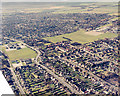
South Benfleet from the air
The housing across the top of the picture comprises much of South Benfleet. In the open area across the middle are Kents Hill Primary Schools (upper left of centre), Holy Family Primary School (lower left centre), and the Appleton School (upper left centre). The houses across the bottom lies just south of the A13 (London Road). The dark line across the top is the railway line to Fenchurch St.
The clear triangle at the bottom left is where the aircraft wing obscured the view.
Image: © Edward Clack
Taken: Unknown
0.24 miles
3
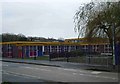
Holy Family Early Learning Centre
This nursery school is at the junction of Kents Hill Rd & Bowers Rd Benfleet.
Image: © Glyn Baker
Taken: 1 Jan 2006
0.24 miles
4
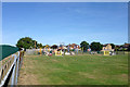
Play area, recreation ground off Villa Road
Image: © Robin Webster
Taken: 11 Sep 2016
0.25 miles