
IMAGES TAKEN NEAR TO
Arundel Gardens, RAYLEIGH, SS6 9GS
Introduction
This page details the photographs taken nearby to Arundel Gardens, SS6 9GS by members of the Geograph project.
The Geograph project started in 2005 with the aim of publishing, organising and preserving representative images for every square kilometre of Great Britain, Ireland and the Isle of Man.

There are currently over 7.5m images from over14,400 individuals and you can help contribute to the project by visiting https://www.geograph.org.uk
Image Map
Images are licensed for reuse under creativecommons.org/licenses/by-sa/2.0
Notes
- Clicking on the map will re-center to the selected point.
- The higher the marker number, the further away the image location is from the centre of the postcode.
Image Listing (58 Images Found)
Images are licensed for reuse under creativecommons.org/licenses/by-sa/2.0
Image
Details
Distance
2
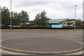
Turning circle at the end of Priory Chase, Rayleigh
Opposite St Nicholas C of E primary school
Image: © David Howard
Taken: 26 Jul 2020
0.08 miles
3
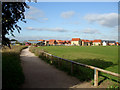
Path to Sweyne Park
This path allows access to Sweyne Park from Priory Chase.
The photo was taken near to this entrance to the park.
The yellow and red buildings are part of Image
Image: © terry joyce
Taken: 21 Oct 2010
0.08 miles
4
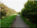
Sweyne Park Bridleway
The Bridleway around Sweyne Park measures approximately 1.3 miles. This part leads towards the Downhall Park Way entrance.
Image: © terry joyce
Taken: 21 Oct 2010
0.08 miles
5
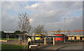
St Nicholas C of E School
This school is a fairly new school built on part of the site of Park School.
It does not appear on the OS Get a Map as yet (15/9/2007).
Its postcode is SS6 9NE.
There are a number of other buildings on the old Park School site.
Rayleigh Leisure Centre in Grid Image and ASDA in Grid Image
The white roof on the left of the photo is that of Makro which is in the same grid.
Image: © terry joyce
Taken: 15 Oct 2007
0.09 miles
6

Sweyne Park, Victoria Avenue entrance
This part of the Bridleway is accessed from Victoria Avenue.
Image: © terry joyce
Taken: 21 Oct 2010
0.09 miles
7
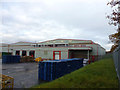
At the back
This is part of the loading area at the back of the Makro store.
Image: © terry joyce
Taken: 26 Nov 2012
0.10 miles
8
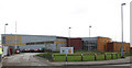
Rayleigh Leisure Centre
Rayleigh Leisure Centre opened in May 2006.
It is one of the buildings on the site of Park School, which was demolished.
The school combined with Sweyne School, to become Sweyne Park School.
It has an Indoor Bowls Arena,an advanced gym, glass walled squash courts, indoor badminton, basketball, netball and outdoor multi-purpose courts.
It's postcode is SS6 9NF.
Image: © terry joyce
Taken: 12 Oct 2007
0.10 miles
9

Sweyne Park, dog walking
Quite a number of dog owners use the park to exercise their dogs. This is close to the Victoria road entrance.
Image: © terry joyce
Taken: 21 Oct 2010
0.11 miles
10
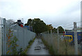
Tarmac Footpath
This footpath used to be a very thin muddy path, now it is completely tarmac.
It links Stirling Close to Rawreth Industrial Estate.
Image: © terry joyce
Taken: 27 Oct 2010
0.11 miles