
IMAGES TAKEN NEAR TO
Bull Lane, RAYLEIGH, SS6 8NW
Introduction
This page details the photographs taken nearby to Bull Lane, SS6 8NW by members of the Geograph project.
The Geograph project started in 2005 with the aim of publishing, organising and preserving representative images for every square kilometre of Great Britain, Ireland and the Isle of Man.

There are currently over 7.5m images from over14,400 individuals and you can help contribute to the project by visiting https://www.geograph.org.uk
Image Map
Images are licensed for reuse under creativecommons.org/licenses/by-sa/2.0
Notes
- Clicking on the map will re-center to the selected point.
- The higher the marker number, the further away the image location is from the centre of the postcode.
Image Listing (16 Images Found)
Images are licensed for reuse under creativecommons.org/licenses/by-sa/2.0
Image
Details
Distance
1
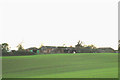
Stevens Farm
The Farm is about 300 metres from HMP Bullwood Hall.
Image: © terry joyce
Taken: 1 Nov 2007
0.03 miles
2
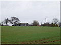
Stevens Farm
This is a view of Stevens Farm from near the entrance of the Footpath from Bull Lane.
Image: © terry joyce
Taken: 4 Jan 2012
0.04 miles
3
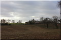
Stevens Farm
Taken from the edge of Hockley Wood
Image: © Robert Eva
Taken: 11 Jan 2017
0.05 miles
4
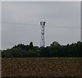
Radio Transmitter
Radio Transmitter viewed North East from the footpath across the field. I believe this Radio Transmitter is used locally by BBC Essex.
Image: © Paul Collins
Taken: 24 Aug 2007
0.07 miles
5
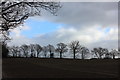
Eastwards from the end of Roach Valley Way
This is taken from close to where the path goes into Bull Lane, then on into Rayleigh.
Image: © Robert Eva
Taken: 11 Jan 2017
0.10 miles
6
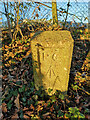
Old Boundary Marker of the former HM Prison Bullwood Hall
Prison Commission Boundary Marker by a chain link fence at the southwest corner of the boundary of the former HM Prison Bullwood Hall. Rayleigh parish. Inscribed P C / ↑ / 8. Dated to the early 1960’s because the Prison Commission became part of the Home Office in 1963 and Bullwood Hall was built as a female borstal in the 1960's.
Milestone Society National ID: EX_PCBULL08em
Image: © L Chinea
Taken: Unknown
0.12 miles
7
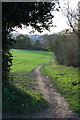
Footpath to Bull Lane
This is part of the path that comes from the B1013 past HMP Bullwood Hall.
The photo was taken near to the Mast in this grid.
It leads to Bull Lane in Rayleigh.
Image: © terry joyce
Taken: 1 Nov 2007
0.14 miles
8
Across the fields by Stevens Farm
Southend can be seen on the horizon
Image: © Robert Eva
Taken: 11 Jan 2017
0.17 miles
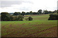
10
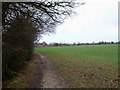
Footpath to the Woods
If you follow this footpath from Bull Lane it joins the Roach Valley Way just South of Hockley Woods.
Image: © terry joyce
Taken: 4 Jan 2012
0.20 miles