
IMAGES TAKEN NEAR TO
Avondale Road, RAYLEIGH, SS6 8NJ
Introduction
This page details the photographs taken nearby to Avondale Road, SS6 8NJ by members of the Geograph project.
The Geograph project started in 2005 with the aim of publishing, organising and preserving representative images for every square kilometre of Great Britain, Ireland and the Isle of Man.

There are currently over 7.5m images from over14,400 individuals and you can help contribute to the project by visiting https://www.geograph.org.uk
Image Map
Images are licensed for reuse under creativecommons.org/licenses/by-sa/2.0
Notes
- Clicking on the map will re-center to the selected point.
- The higher the marker number, the further away the image location is from the centre of the postcode.
Image Listing (5 Images Found)
Images are licensed for reuse under creativecommons.org/licenses/by-sa/2.0
Image
Details
Distance
1
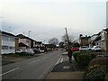
Bull Lane
Roadworks at the junction with Avondale Road
Image: © John Myers
Taken: 18 Jan 2021
0.11 miles
2
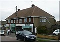
Grove Road Shopping Arcade
On the South east corner of Grove Road and The Chase, the 1950's shopping arcade that is still the centre of this community. Post Office, Green Grocers and Butchers with a Wedding shop! The Butcher is out on the pavement discussing the day with a passer-by.
Image: © Paul Collins
Taken: 24 Aug 2007
0.16 miles
3
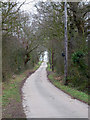
Bull Lane
This is the road to Stevens Farm & Fisher's Farm. There is a footpath, which is part way up this hill on the left.
Image: © terry joyce
Taken: 4 Jan 2012
0.22 miles
4
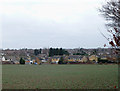
Bull Field
This field adjacent to Bull Lane is on the western edge of this grid. The houses are in grid Image
Image: © terry joyce
Taken: 4 Jan 2012
0.22 miles
5
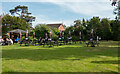
Green near Rayleigh Lodge
If possible I try and find some green space in a square, there was very little is this particular square, but I did find this green near the "Rayleigh Lodge" pub.
Image: © Roger Jones
Taken: 19 May 2022
0.23 miles