
IMAGES TAKEN NEAR TO
Lychgate Industrial Estate, Arterial Road, RAYLEIGH, SS6 7TZ
Introduction
This page details the photographs taken nearby to Lychgate Industrial Estate, Arterial Road, SS6 7TZ by members of the Geograph project.
The Geograph project started in 2005 with the aim of publishing, organising and preserving representative images for every square kilometre of Great Britain, Ireland and the Isle of Man.

There are currently over 7.5m images from over14,400 individuals and you can help contribute to the project by visiting https://www.geograph.org.uk
Image Map
Images are licensed for reuse under creativecommons.org/licenses/by-sa/2.0
Notes
- Clicking on the map will re-center to the selected point.
- The higher the marker number, the further away the image location is from the centre of the postcode.
Image Listing (5 Images Found)
Images are licensed for reuse under creativecommons.org/licenses/by-sa/2.0
Image
Details
Distance
1
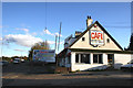
The Blinking Owl Cafe
The Cafe is on the London Bound Carriageway of the A127, just before the junction with the A1245.
Behind the Cafe are quite a number of Industrial Businesses.
Image: © terry joyce
Taken: 29 Oct 2007
0.09 miles
2
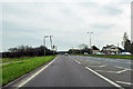
Slip road onto A127 from A1245 roundabout
Towards Southend, with a 50 limit in force.
Image: © Robin Webster
Taken: 6 Apr 2018
0.11 miles
3
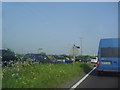
Traffic merging from the A1245 to the A127, Thundersley
Image: © David Howard
Taken: 24 May 2012
0.18 miles
4
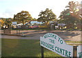
Woodside Centre
The Garden Centre is on the London bound carriageway of the A127 approximately 1 mile from the Rayleigh Weir Roundabout.
Image: © terry joyce
Taken: 29 Oct 2007
0.19 miles
5
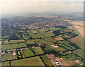
Aerial view of New Thundersley and Plotlands from the north-east
This image is taken from a point to the west of Image, and shows more land to the north of that (bottom of the picture). To the bottom right is Lychgate Farm. The tracks in the field to the left of this were probably made by motor cycles. (At the time many of these fields were used by unlicensed motor-bikes.) The A130 runs along the right edge, and along the left edge is Coniston Road.
Image: © Edward Clack
Taken: 3 Aug 1987
0.25 miles