
IMAGES TAKEN NEAR TO
Daws Heath Road, RAYLEIGH, SS6 7NS
Introduction
This page details the photographs taken nearby to Daws Heath Road, SS6 7NS by members of the Geograph project.
The Geograph project started in 2005 with the aim of publishing, organising and preserving representative images for every square kilometre of Great Britain, Ireland and the Isle of Man.

There are currently over 7.5m images from over14,400 individuals and you can help contribute to the project by visiting https://www.geograph.org.uk
Image Map
Images are licensed for reuse under creativecommons.org/licenses/by-sa/2.0
Notes
- Clicking on the map will re-center to the selected point.
- The higher the marker number, the further away the image location is from the centre of the postcode.
Image Listing (13 Images Found)
Images are licensed for reuse under creativecommons.org/licenses/by-sa/2.0
Image
Details
Distance
1

Aerial view of Hurst Farm and Tile Wood
The buildings in the centre are known by the name of 'Hurst Farm' (amongst other less complementary names). Today, there are even more buildings on the site, which benefits from being designated 'Agricultural'.
The road along the lower right is the A127 (Southend Arterial Road). The road joining it is St Michael's Road, which leads to St Michael's Church in Daws Heath.
The woods beyond are Tile Wood on the left and Wyburns Wood on the right. These two woods merge at this point. Originally Wyburns Wood was known as 'Tile Wood West' (and Tile Wood was 'Tile Wood East').
Image: © Edward Clack
Taken: 3 Aug 1987
0.10 miles
3
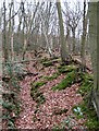
Wood boundary, Tile Wood
Ancient bank and ditch wood boundary.
Image: © John Myers
Taken: 30 Dec 2007
0.12 miles
5
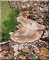
Oyster Mushrooms, Tile Wood
Oyster mushrooms, Pleurotus ostreatus. A fairly common winter species.
Image: © John Myers
Taken: 30 Dec 2007
0.14 miles
6

Tile Wood Boundary
This earthwork is the ancient boundary between Daws Heath and Tile Wood. The wood was formerly owned by Westminster Abbey. In modern times title rested with the Church Commissioners however in 2010 the reserve was purchased for £50,000 following an appeal for funds to members of the Essex Wildlife Trust http://www.essexwt.org.uk/. The donor’s wallets will not have much time to recover because the Trusts biggest project ever is about to get under way at Image
Image: © Glyn Baker
Taken: 8 May 2010
0.16 miles
7

Tile Wood Wood Pile
It is thought that Tile Wood is so named because of the Roman tiles that on occasions still surface. Although proper excavations have not been undertaken there may be the remains of a villa somewhere in the vicinity. The wood here from recent coppicing is waiting to be turned into charcoal. You can learn about how it is made by visiting Image The group of people in the background are donors who helped raise £50,000 to buy the freehold of the wood for the Essex Wildlife Trust. They are being given a guided tour by one of the deputy wardens. See also Image The donors wallets will not have much time to recover because the Trusts biggest project ever is about to get under way at Image
Image: © Glyn Baker
Taken: 8 May 2010
0.19 miles
8

Tile Wood Reserve
This entrance to Image nature reserve is near Little Haven Reserve. This was formerly leased from the Church Commissioners by Essex Wildlife Trust who now own the site. To learn more about the nature reserve see http://www.essexwt.org.uk/visitor_centres__nature_reserves/Tile%20Wood.htm
Image: © Glyn Baker
Taken: 20 Jun 2009
0.21 miles
9
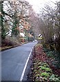
Daws Heath Road, Rayleigh
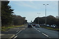
I wouldn't even try to do 60 mph down here. Narrow back road much used as a "rat-run" when the A127 is congested
Image: © John Myers
Taken: 23 Dec 2006
0.22 miles
10

St. Michael's Road
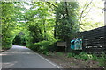
Popular rural rat run from the A127 to Hadleigh with quite heavy traffic at times.
Tile Wood nature Reserve to the right.
Image: © John Myers
Taken: 14 Aug 2007
0.23 miles