
IMAGES TAKEN NEAR TO
Love Lane, RAYLEIGH, SS6 7DL
Introduction
This page details the photographs taken nearby to Love Lane, SS6 7DL by members of the Geograph project.
The Geograph project started in 2005 with the aim of publishing, organising and preserving representative images for every square kilometre of Great Britain, Ireland and the Isle of Man.

There are currently over 7.5m images from over14,400 individuals and you can help contribute to the project by visiting https://www.geograph.org.uk
Image Map
Images are licensed for reuse under creativecommons.org/licenses/by-sa/2.0
Notes
- Clicking on the map will re-center to the selected point.
- The higher the marker number, the further away the image location is from the centre of the postcode.
Image Listing (32 Images Found)
Images are licensed for reuse under creativecommons.org/licenses/by-sa/2.0
Image
Details
Distance
1
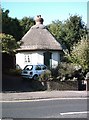
The Dutch Cottage, Rayleigh
Tiny, octagonal cottage on Crown Hill and Rochford District Council's housing stock. A condition of the lease requires the cottage to be open to the public on one afternoon a week.
Image: © John Myers
Taken: 27 Aug 2006
0.11 miles
2
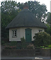
Dutch Cottage, Rayleigh (built 1621)
Grade II listed cottage, described at this http://list.english-heritage.org.uk/resultsingle.aspx?uid=1112678.
Image: © Jim Osley
Taken: 26 Sep 2013
0.12 miles
3
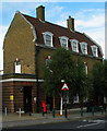
Former post office, Rayleigh (built 1931)
Retains Royal Mail Delivery Office functions.
Image: © Jim Osley
Taken: 27 Sep 2013
0.12 miles
4
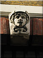
Sculpted head, Rayleigh Post Office
A feature of a number of inter-war post office buildings. The head represents the winged figure of Mercury/Hermes, the messenger of the gods in Roman and Greek mythology.
Image: © Jim Osley
Taken: 27 Sep 2013
0.12 miles
5
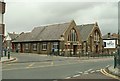
The Salvation Army church, High Street, Rayleigh
Image: © Robert Edwards
Taken: 13 Aug 2008
0.12 miles
6
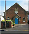
Victorian school building, Rayleigh
Plaque dates the building as 1864.
Image: © Jim Osley
Taken: 27 Sep 2013
0.13 miles
7
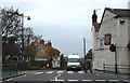
The Crown on the Hill
This is the top of Crown Hill at the junction with Rayleigh High Street.
The white building is Ye Olde Crown Pub and the building on the other side of the Zebra Crossing is the Public Toilets.
Rayleigh Station is down this hill.
Image: © terry joyce
Taken: 5 Nov 2007
0.14 miles
9
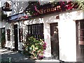
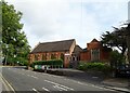
The Crown, Rayleigh
At the Junction of Crown Hill and The High Street.
Image: © John Myers
Taken: 27 Aug 2006
0.15 miles
10
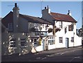
The Paul Pry, Rayleigh
Pub on the High Road.
Image: © John Myers
Taken: 27 Aug 2006
0.15 miles