
IMAGES TAKEN NEAR TO
Hampton Court, HOCKLEY, SS5 4XE
Introduction
This page details the photographs taken nearby to Hampton Court, SS5 4XE by members of the Geograph project.
The Geograph project started in 2005 with the aim of publishing, organising and preserving representative images for every square kilometre of Great Britain, Ireland and the Isle of Man.

There are currently over 7.5m images from over14,400 individuals and you can help contribute to the project by visiting https://www.geograph.org.uk
Image Map
Images are licensed for reuse under creativecommons.org/licenses/by-sa/2.0
Notes
- Clicking on the map will re-center to the selected point.
- The higher the marker number, the further away the image location is from the centre of the postcode.
Image Listing (4 Images Found)
Images are licensed for reuse under creativecommons.org/licenses/by-sa/2.0
Image
Details
Distance
1
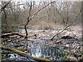
Marylands Wood - The Pond
Quite large, possibly the biggest pond remaining in any of the woods of S.E Essex. In dire need of some conservation work.
Image: © John Myers
Taken: 5 Apr 2006
0.12 miles
2
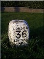
Old Milestone by the B1013, Main Road, Hockley
Carved stone post by the B1013, in parish of Hockley (Rochford District), Main Road, by No. 72, by the road, on North side of road. Erected by the Rochford Hundred (Division of Essex First District) turnpike trust in the 19th century.
Inscription reads:-
LONDON
36
SOUTHEND
7
Carved benchmark recorded.
Grade II listed.
List Entry Number: 1112669 https://historicengland.org.uk/listing/the-list/list-entry/1112669
Milestone Society National ID: EX_RYRO36
Image: © JV Nicholls
Taken: Unknown
0.22 miles
3
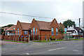
Former school, Hockley
On the front is a monogram 'HSB', presumably Hockley School Board, and date 1903. Now the head office of Seetec, who deal in supported employment.
Image: © Robin Webster
Taken: 7 Sep 2014
0.23 miles
4

Vanishing Point
London bound track from foot crossing on Hockley Parish FP13.
Image: © John Myers
Taken: 27 Jul 2006
0.25 miles