
IMAGES TAKEN NEAR TO
Barnwell Drive, HOCKLEY, SS5 4UA
Introduction
This page details the photographs taken nearby to Barnwell Drive, SS5 4UA by members of the Geograph project.
The Geograph project started in 2005 with the aim of publishing, organising and preserving representative images for every square kilometre of Great Britain, Ireland and the Isle of Man.

There are currently over 7.5m images from over14,400 individuals and you can help contribute to the project by visiting https://www.geograph.org.uk
Image Map
Images are licensed for reuse under creativecommons.org/licenses/by-sa/2.0
Notes
- Clicking on the map will re-center to the selected point.
- The higher the marker number, the further away the image location is from the centre of the postcode.
Image Listing (28 Images Found)
Images are licensed for reuse under creativecommons.org/licenses/by-sa/2.0
Image
Details
Distance
1
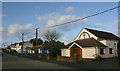
Bramerton Road Community Church, Hockley
The church is part of the United Reformed Church which was originally formed in 1972 through the amalgamation of the English and Welsh Congregationalists and the English Presbyterians. This particular church dates from 1926.
Image: © David Kemp
Taken: 17 Feb 2020
0.08 miles
2
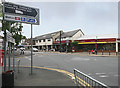
Hockley centre
Taken from Southend Road with Woodlands Road (left), Main Road (centre) and Spa Road (right).
Image: © David Kemp
Taken: 1 Jul 2013
0.08 miles
3
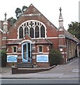
Methodist Church, Hockley
Hockley and Hawkwell Methodist Church, Main Road.
Image: © John Myers
Taken: 20 Aug 2006
0.09 miles
5
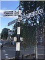
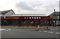
Direction Sign – Signpost beside the B1023 in Hockley
Located on the southwest side of the crossroads on the B1023 opposite the Spa Hotel in Hockley parish. 3 arms and disc finial. The arm indicating B1013; ROCHFORD 3¼ / SOUTHEND 8¾ went missing some time between August 2019 and November 2020. See also https://www.geograph.org.uk/photo/8062400 and https://www.geograph.org.uk/photo/6515828 https://www.geograph.org.uk/photo/7488470.
Milestone Society National ID: EX_TQ8392
Image: © R Grant
Taken: 19 Aug 2019
0.09 miles
6
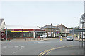
Hockley centre
Taken from Woodlands Road with Main Road (left), Spa Road (centre) and Southend Road (right). Road widening and the replacement of C19 terraced cottages with low-rise commercial premises have somewhat altered the appearance of the village over the last fifty years.
Image: © David Kemp
Taken: 1 Jul 2013
0.10 miles
7
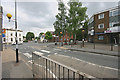
Hockley centre
Taken from Main Road showing Spa Road (left), Southend Road (centre) and Woodlands Road (right). Hockley has grown considerably in the last half century with newer low-rise buildings replacing terraced cottages and small shops. However 'The Spa Hotel' (left) has remained a constant feature over the years.
Image: © David Kemp
Taken: 1 Jul 2013
0.10 miles
8
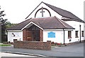
Congregational Church, Hockley
In Bramerton Road
Image: © John Myers
Taken: 20 Aug 2006
0.10 miles
10
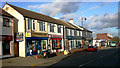
Shops in Spa Road, Hockley
Taken from opposite the corner of Bramerton Road.
Image: © David Kemp
Taken: 17 Feb 2020
0.12 miles