
IMAGES TAKEN NEAR TO
Elmwood Avenue, HOCKLEY, SS5 4ND
Introduction
This page details the photographs taken nearby to Elmwood Avenue, SS5 4ND by members of the Geograph project.
The Geograph project started in 2005 with the aim of publishing, organising and preserving representative images for every square kilometre of Great Britain, Ireland and the Isle of Man.

There are currently over 7.5m images from over14,400 individuals and you can help contribute to the project by visiting https://www.geograph.org.uk
Image Map
Images are licensed for reuse under creativecommons.org/licenses/by-sa/2.0
Notes
- Clicking on the map will re-center to the selected point.
- The higher the marker number, the further away the image location is from the centre of the postcode.
Image Listing (13 Images Found)
Images are licensed for reuse under creativecommons.org/licenses/by-sa/2.0
Image
Details
Distance
1
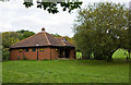
The Kath Batts Building
Brick built camping accommodation on the Belchamps Scout Camping Centre site. It provides sleeping and catering facilities for up to 24 people.
Image: © Martin Addison
Taken: 17 Oct 2010
0.12 miles
2
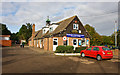
Belchamps Scout Centre
Located beside Hockley woods, the centre provides camping and activities for the scout organisation and other youth groups. Activities include climbing, archery, rifle shooting and an assault course. The building in the centre of the photo is the main reception centre. The track on the left leads to some of the ranges and other activities.
Image: © Martin Addison
Taken: 16 Oct 2010
0.12 miles
4
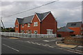
Main Road at the junction of Highwell Gardens
Image: © David Howard
Taken: 26 Jul 2020
0.16 miles
5
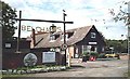
Belchamps scout site
Large camp site on edge of Hockley Woods
Image: © John Myers
Taken: 25 Aug 2006
0.16 miles

7
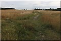
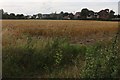
Field by Main Road, Hawkwell
This is also a public footpath
Image: © David Howard
Taken: 26 Jul 2020
0.18 miles

9
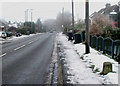
Main Road, Hawkwell
This is Main Road in Hawkwell. In the bottom right corner of the picture there is a Milestone that is shown on the OS map. The Milestone is listed.
See Image and Image
Image: © terry joyce
Taken: 6 Dec 2010
0.20 miles
10
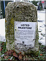
Listed Milestone
This note was attached to the side of the Milestone that is located on the B1013 'Main Road' approximately 70 metres from the junction of Tudor Way.
To see the front Image
To see its location Image
Image: © terry joyce
Taken: 6 Dec 2010
0.23 miles