
IMAGES TAKEN NEAR TO
Doggetts Chase, ROCHFORD, SS4 3RW
Introduction
This page details the photographs taken nearby to Doggetts Chase, SS4 3RW by members of the Geograph project.
The Geograph project started in 2005 with the aim of publishing, organising and preserving representative images for every square kilometre of Great Britain, Ireland and the Isle of Man.

There are currently over 7.5m images from over14,400 individuals and you can help contribute to the project by visiting https://www.geograph.org.uk
Image Map
Images are licensed for reuse under creativecommons.org/licenses/by-sa/2.0
Notes
- Clicking on the map will re-center to the selected point.
- The higher the marker number, the further away the image location is from the centre of the postcode.
Image Listing (4 Images Found)
Images are licensed for reuse under creativecommons.org/licenses/by-sa/2.0
Image
Details
Distance
1
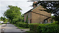
Rural Housing, Doggetts Chase, Rochford
Most likely built for those working on Doggetts farm.
Image: © Roger Jones
Taken: 30 May 2022
0.01 miles
2
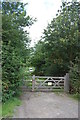
Gated track to reservoir
Entrance to private fishery
Image: © John Myers
Taken: 14 Aug 2011
0.08 miles
4
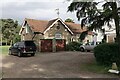
Carriage House near Doggetts (Listed Structure)
Stables, tack room and carriagehouse approximately 3 metres north east of Doggetts farmhouse.
Listed Building, Grade: II
List Entry Number: 1112620 https://historicengland.org.uk/listing/the-list/list-entry/1112620
Mid C19. Gault brick. Red plain tiled roof. 2 storeys. Central gable with barge boards, clock dated 1856, weathervane to apex.
Image: © Roger Jones
Taken: 30 May 2022
0.11 miles