IMAGES TAKEN NEAR TO
Paglesham Road, ROCHFORD, SS4 2DS
Introduction
This page details the photographs taken nearby to Paglesham Road, SS4 2DS by members of the Geograph project.
The Geograph project started in 2005 with the aim of publishing, organising and preserving representative images for every square kilometre of Great Britain, Ireland and the Isle of Man.

There are currently over 7.5m images from over14,400 individuals and you can help contribute to the project by visiting https://www.geograph.org.uk
Image Map (Loading...)


Getting Data...Please wait
Leaflet Map data © OpenStreetMap
Images are licensed for reuse under creativecommons.org/licenses/by-sa/2.0
Notes
- Clicking on the map will re-center to the selected point.
- The higher the marker number, the further away the image location is from the centre of the postcode.
Image Listing (9 Images Found)
Images are licensed for reuse under creativecommons.org/licenses/by-sa/2.0
Image
Details
Distance
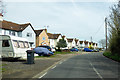
1
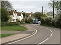
Jubilee Cottages, Paglesham
This is the most built-up part of the gridsquare. The rest is flat and open farmland.
Image: © David Kemp
Taken: 2 May 2006
0.03 miles
3
Footpath and drains
Jubilee Cottages in the distance
Image: © John Myers
Taken: 12 Mar 2012
0.04 miles
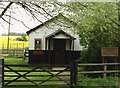
4
Congregational Church
Paglesham East End
Image: © Julieanne Savage
Taken: 10 Dec 2006
0.07 miles
5
Jubilee Cottages, Paglesham
If maps are to be believed, the relevant jubilee seems to be the Silver Jubilee of George V, 1935.
Image: © Robin Webster
Taken: 6 Apr 2018
0.08 miles
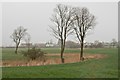
6
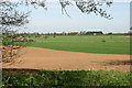
Across the fields to Paglesham Churchend
Taken from the Roach Valley Way footpath. The tower of Paglesham church can be seen on the horizon.
Image: © David Kemp
Taken: 6 Apr 2011
0.10 miles
7
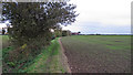
Footpath and arable field
Footpath running south from Church End.
Image: © Roger Jones
Taken: 3 Nov 2012
0.14 miles
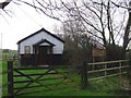
8
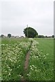
Footpath to Jubilee Cottages
This path connects Jubilee Cottages on Paglesham Road with Church End.
Image: © Glyn Baker
Taken: 4 Jun 2016
0.23 miles
9
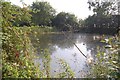
Pond, Paglesham Churchend
This pond lies just to the south of the church. Presumably a former farm pond, it is now heavily overgrown.
Image: © Trevor Harris
Taken: 30 Aug 2008
0.25 miles