IMAGES TAKEN NEAR TO
Winterbon Mews, ROCHFORD, SS4 1GS
Introduction
This page details the photographs taken nearby to Winterbon Mews, SS4 1GS by members of the Geograph project.
The Geograph project started in 2005 with the aim of publishing, organising and preserving representative images for every square kilometre of Great Britain, Ireland and the Isle of Man.

There are currently over 7.5m images from over14,400 individuals and you can help contribute to the project by visiting https://www.geograph.org.uk
Image Map
Images are licensed for reuse under creativecommons.org/licenses/by-sa/2.0
Notes
- Clicking on the map will re-center to the selected point.
- The higher the marker number, the further away the image location is from the centre of the postcode.
Image Listing (104 Images Found)
Images are licensed for reuse under creativecommons.org/licenses/by-sa/2.0
Image
Details
Distance
2
West Street, Rochford - north side looking east
Image: © David Kemp
Taken: 23 Jun 2018
0.01 miles
3
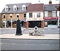
Pump and horse trough - Market square, Rochford
Trough commemorates coronation of King Edward VII. The pump seems strangely incongruous and I don't remember it from my youth. I also seem to remember the trough being somewhere else but I could well be wrong.
Here's where the Roach Valley Way goes urban for a bit through the heart of Rochford.
In fact the trough was originally situated at the entrance to Hockley Woods near the Bull Inn from where I remember it as a child.
Image: © John Myers
Taken: 20 Aug 2006
0.01 miles
4
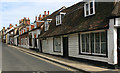
West Street, Rochford - south side looking east
Image: © David Kemp
Taken: 23 Jun 2018
0.01 miles
5
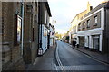
West Street, Rochford
Looking westwards.
Image: © Robert Eva
Taken: 11 Jan 2017
0.02 miles
6
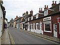
Rochford: West Street
This is West Street viewed looking east, and used to be the main street leaving the town in this direction.
Image: © Nigel Cox
Taken: 3 Aug 2008
0.03 miles
7
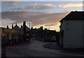
Rochford. Junction of West St and Bradley Way
Image: © Robert Eva
Taken: 11 Jan 2017
0.03 miles
8
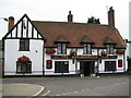
Rochford: The Marlborough Head
The Marlborough Head public house is at the bottom end of West Street, estimated to be 17th century or earlier but extensively remodelled in the 20th century.
Image: © Nigel Cox
Taken: 3 Aug 2008
0.03 miles
9

West Street, Rochford
Looking east, many of the buildings on this south side are grade II listed.
Image: © Robin Webster
Taken: 19 Apr 2015
0.04 miles