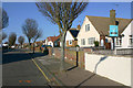
IMAGES TAKEN NEAR TO
Admirals Walk, SOUTHEND-ON-SEA, SS3 9FN
Introduction
This page details the photographs taken nearby to Admirals Walk, SS3 9FN by members of the Geograph project.
The Geograph project started in 2005 with the aim of publishing, organising and preserving representative images for every square kilometre of Great Britain, Ireland and the Isle of Man.

There are currently over 7.5m images from over14,400 individuals and you can help contribute to the project by visiting https://www.geograph.org.uk
Image Map
Images are licensed for reuse under creativecommons.org/licenses/by-sa/2.0
Notes
- Clicking on the map will re-center to the selected point.
- The higher the marker number, the further away the image location is from the centre of the postcode.
Image Listing (66 Images Found)
Images are licensed for reuse under creativecommons.org/licenses/by-sa/2.0
Image
Details
Distance
1
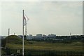
View of blocks of flats in Thorpe Bay/Southend East from the coastal path at Shoeburyness
Looking north-northwest.
Image: © Robert Lamb
Taken: 17 Jun 2017
0.01 miles
2
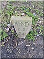
Old Boundary Marker on the B1016 Ness Road, Shoeburyness
War Department Boundary Marker at the inner edge of the pavement on the southeast side of the T junction of the B1016 Ness Road and New Barge Pier Road. Southend-on-Sea unitary authority. Inscribed W ↑ D / B S / 34 and marking the boundary of Shoeburyness Old Ranges. Marker No. 34 was marked at Image 70 metres southwest on the 1923 25" OS map.
Milestone Society National ID: EX_WDSHOE34em
Image: © L Chinea
Taken: 6 Feb 2021
0.03 miles
3
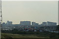
View of blocks of flats in Thorpe Bay/Southend East from the coastal path at Shoeburyness #2
Looking north-northwest.
Image: © Robert Lamb
Taken: 17 Jun 2017
0.03 miles
4

Gunners Park
This is Gunners Park once part of the Garrison now a public open space managed for wildlife see http://www.wildessex.net/sites/Gunners%20Park.htm
Image: © Glyn Baker
Taken: 22 Jan 2011
0.07 miles
5
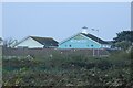
View of the Harvester Shorehouse on Shoebury Common Road from Gunners Park
Looking north-northwest.
Image: © Robert Lamb
Taken: 12 Nov 2021
0.09 miles
7
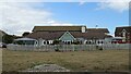
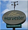
The Shorehouse
Harvester public house on Ness Road.
See Image] for sign.
Image: © JThomas
Taken: 23 Aug 2022
0.10 miles
8

Shoebury Old Ranges
This Essex Wildlife Trust reserve http://www.essexwt.org.uk/ is divided into two segments one with public access and the area shown that is securely fenced to protect the extremely fragile coastal ecology. Continue on a virtual tour of Wildlife Trust Reserves in Essex by visiting Image
Image: © Glyn Baker
Taken: 20 Jun 2009
0.10 miles
9
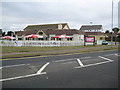
Shoebury Common: The Shorehouse
Long before all the residential building took place in this area there was a solitary building on this site called the Shore House and it is shown in isolation on the 1880 edition of the Ordnance Survey mapping. The building is one of the very few that the Ordnance Survey deign to indicate as a PH (Public House) in a predominantly built-up area on their 1:50,000 scale mapping. The current Shorehouse is a Harvester chain outlet. The street in front is Ness Road.
Image: © Nigel Cox
Taken: 3 Aug 2008
0.10 miles