
IMAGES TAKEN NEAR TO
High Street, SOUTHEND-ON-SEA, SS3 9AW
Introduction
This page details the photographs taken nearby to High Street, SS3 9AW by members of the Geograph project.
The Geograph project started in 2005 with the aim of publishing, organising and preserving representative images for every square kilometre of Great Britain, Ireland and the Isle of Man.

There are currently over 7.5m images from over14,400 individuals and you can help contribute to the project by visiting https://www.geograph.org.uk
Image Map
Images are licensed for reuse under creativecommons.org/licenses/by-sa/2.0
Notes
- Clicking on the map will re-center to the selected point.
- The higher the marker number, the further away the image location is from the centre of the postcode.
Image Listing (163 Images Found)
Images are licensed for reuse under creativecommons.org/licenses/by-sa/2.0
Image
Details
Distance
2
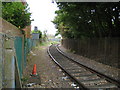
Shoeburyness: Branch line railway to MOD Pig's Bay
The railway line starts in the sidings to the west of Shoeburyness station, swings around the south side of the station in this photograph here, crosses Shoebury High Street by means of a level crossing before reaching the MOD base at Pig's Bay. Judging by the shininess of the rails the track is evidently used on a regular basis. One of the uses of the MOD base is for the storage of withdrawn rolling stock prior to scrapping.
The London Tilbury and Southend Railway reached Shoeburyness in 1884 and this branch line is already shown in the Ordnance Survey map edition of 1898.
From a strictly Geograph point of view this image is at the junction of four grid squares, and could equally well have been submitted for Image, Image or Image
Image: © Nigel Cox
Taken: 3 Aug 2008
0.01 miles
3
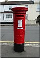
George V postbox on High Street, Shoeburyness
Postbox No. SS3 310.
Image: © JThomas
Taken: 23 Aug 2022
0.01 miles
4
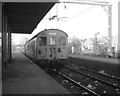
Shoeburyness station
Electric multiple unit train at the eastern end of the London, Tilbury and Southend route, at Shoeburyness, seen in the days of British Railways.
Image: © Dr Neil Clifton
Taken: 18 Feb 1980
0.02 miles
5
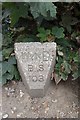
Old Boundary Marker by High Street, Shoeburyness
Estate Boundary Marker - War Department by the UC road, in parish of Southend on Sea (Southend on Sea District), Shoeburyness High Street, just South of level crossing.
Inscription reads:-
W^D
B S
103
Surveyed
Milestone Society National ID: EX_WDSHOE103em
Image: © Milestone Society
Taken: Unknown
0.02 miles
7
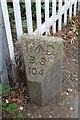
Old Boundary Marker by Shoeburyness High Street
Estate Boundary Marker - War Department #104 by the UC road, in parish of Southend On Sea (Southend On Sea District), Shoeburyness High Street, North of level crossing.
Surveyed
Milestone Society National ID: EX_WDSHOE104em
Image: © Milestone Society
Taken: Unknown
0.02 miles
8
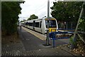
Shoeburyness Railway Station
C2C Class 357, No. 357035.
Image: © JThomas
Taken: 23 Aug 2022
0.02 miles
9
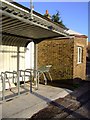
ASDA trolley, Shoeburyness station
Image: © Julieanne Savage
Taken: 4 Feb 2007
0.02 miles
10
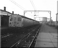
Shoeburyness station
Another view of the terminal station, showing track litter, class 302 train as then used on these services, and huge gasholder in the distance.
Image: © Dr Neil Clifton
Taken: 18 Feb 1980
0.02 miles