
IMAGES TAKEN NEAR TO
New Road, SOUTHEND-ON-SEA, SS3 0DJ
Introduction
This page details the photographs taken nearby to New Road, SS3 0DJ by members of the Geograph project.
The Geograph project started in 2005 with the aim of publishing, organising and preserving representative images for every square kilometre of Great Britain, Ireland and the Isle of Man.

There are currently over 7.5m images from over14,400 individuals and you can help contribute to the project by visiting https://www.geograph.org.uk
Image Map
Images are licensed for reuse under creativecommons.org/licenses/by-sa/2.0
Notes
- Clicking on the map will re-center to the selected point.
- The higher the marker number, the further away the image location is from the centre of the postcode.
Image Listing (23 Images Found)
Images are licensed for reuse under creativecommons.org/licenses/by-sa/2.0
Image
Details
Distance
1
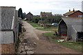
Oxenham Farm
Here the farm is seen from the sea wall. The footpath to Great Wakering is straight ahead.
Image: © Trevor Harris
Taken: 28 Feb 2009
0.01 miles
2
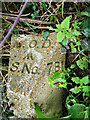
Old Boundary Marker at Oxenham Farm
MOD Boundary Marker beside a public footpath at Oxenham Farm. Great Wakering parish. Inscribed MOD / ↑ / B S No 7 B 1 and on the boundary of Shoeburyness New Ranges.
Milestone Society National ID: EX_MODWAKB7em
Image: © L Chinea
Taken: 4 Feb 2021
0.01 miles
3
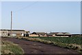
Oxenham Farm, Great Wakering
Taken looking north. The sea wall can be seen on the far right.
Image: © David Kemp
Taken: 29 Jan 2006
0.01 miles
4
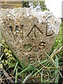
Old Boundary Marker at Oxenham Farm
War Department Boundary Marker beside a public footpath at Oxenham Farm. Great Wakering parish. Inscribed W ↑ D / B S / B4 and on the boundary of Shoeburyness New Ranges.
Milestone Society National ID: EX_WDWAKB4em
Image: © L Chinea
Taken: 4 Feb 2021
0.03 miles
5
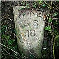
Old Boundary Marker at Oxenham Farm
Fallen War Department Boundary Marker beside a public footpath east of Oxenham Farm. Great Wakering parish. Inscribed W ↑ D / B S / 18 and marking the boundary of Shoeburyness New Ranges.
Milestone Society National ID: EX_WDWAK18em
Image: © L Chinea
Taken: 6 Feb 2021
0.04 miles
6
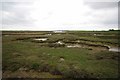
Saltmarsh Near Oxenham Farm
Looking towards Havengore Bridge
Image: © Glyn Baker
Taken: 17 May 2013
0.05 miles
7
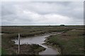
Towards Rushley Island
The scene from Oxenham Farm to Rushley Island
Image: © Glyn Baker
Taken: 17 May 2013
0.05 miles
8
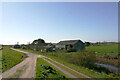
Oxenham Farm, Great Wakering - north aspect
Image: © David Kemp
Taken: 30 Mar 2021
0.06 miles
9
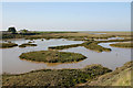
Saltmarsh east of Oxenham Farm, Great Wakering
Oxenham Farm can be seen on the left. The water in the foreground is an inlet from Havengore Creek.
Image: © David Kemp
Taken: 20 Apr 2019
0.09 miles
10
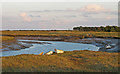
Havengore Creek, Great Wakering
Havengore Creek links the Thames Estuary and the River Roach.
This picture taken from the public footpath along the sea wall.
Image: © Roger Jones
Taken: 1 Sep 2019
0.12 miles