
IMAGES TAKEN NEAR TO
Landwick Cottages, SOUTHEND-ON-SEA, SS3 0DH
Introduction
This page details the photographs taken nearby to Landwick Cottages, SS3 0DH by members of the Geograph project.
The Geograph project started in 2005 with the aim of publishing, organising and preserving representative images for every square kilometre of Great Britain, Ireland and the Isle of Man.

There are currently over 7.5m images from over14,400 individuals and you can help contribute to the project by visiting https://www.geograph.org.uk
Image Map
Images are licensed for reuse under creativecommons.org/licenses/by-sa/2.0
Notes
- Clicking on the map will re-center to the selected point.
- The higher the marker number, the further away the image location is from the centre of the postcode.
Image Listing (15 Images Found)
Images are licensed for reuse under creativecommons.org/licenses/by-sa/2.0
Image
Details
Distance
1
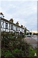
Landwick Cottages
Dating from the 18th century , these isolated cottages must have been very isolated back then.
Image: © John Myers
Taken: 9 Jan 2015
0.01 miles
2
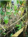
Old Boundary Marker northwest of Landwick Cottages
War Department Boundary Marker beside a public footpath northwest of Landwick Cottages. Great Wakering parish. Inscribed W ↑ D / B S / 38 and on the boundary of Shoeburyness New Ranges.
Milestone Society National ID: EX_WDWAK38em
Image: © L Chinea
Taken: 4 Feb 2021
0.02 miles
3
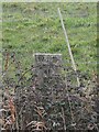
Old Boundary Marker south of Landwick Cottages
War Department Boundary Marker visible from the south side of New Road / Stairs Road across a ditch, south of Landwick Cottages. Great Wakering parish. Inscribed W ↑ D / B S / 41 and on the boundary of Shoeburyness New Ranges.
Milestone Society National ID: EX_WDWAK41em
Image: © L Chinea
Taken: 4 Feb 2021
0.05 miles
4
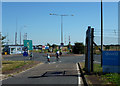
Landwick Gate
This is the entrance to Foulness Island from Great Wakering.
Taken during the Foulness Bike Ride.
Image: © terry joyce
Taken: 9 Sep 2012
0.05 miles
5
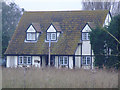
Landwick Cottages, Samuel's Corner
These beautiful cottages date back to the 1700s and lie just before the MOD station at Havengore Bridge.
Image: © Julieanne Savage
Taken: 9 Dec 2006
0.07 miles
6
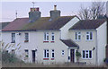
Landwick Cottages, Samuel's Corner, Essex
These beautiful cottages date back to the 1700s and lie just before the MOD station at Havengore Bridge.
Image: © Julieanne Savage
Taken: 9 Dec 2006
0.07 miles
7
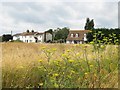
Great Wakering: Samuel's Corner
These cottages originally formed the hamlet of Samuel's Corner. Probably as a result of the need for civilian employees to work on the former War Department property and ranges on Foulness Island there was a rapid expansion of housing from this location back along the road towards Great Wakering in the early part of the 20th century.
Image: © Nigel Cox
Taken: 3 Aug 2008
0.10 miles
8
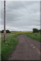
Footpath 16
This is the path to Oxenham Farm
Image: © Glyn Baker
Taken: 17 May 2013
0.10 miles
9
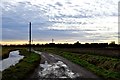
The road from Oxenham Farm
In centre shot, on the other side of the perimeter fence is an MOD radar installation on Shoeburyness New Ranges
Image: © John Myers
Taken: 9 Jan 2015
0.12 miles
10
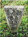
Old Boundary Marker at Samuel's Corner
War Department Boundary Marker on the southeast side of New Road / Stairs Road at Samuel's Corner. Great Wakering parish. Inscribed W ↑ D / B S / 42 and on the boundary of Shoeburyness New Ranges.
Milestone Society National ID: EX_WDWAK42em
Image: © L Chinea
Taken: 4 Feb 2021
0.14 miles