
IMAGES TAKEN NEAR TO
Eastwoodbury Lane, SOUTHEND-ON-SEA, SS2 6UU
Introduction
This page details the photographs taken nearby to Eastwoodbury Lane, SS2 6UU by members of the Geograph project.
The Geograph project started in 2005 with the aim of publishing, organising and preserving representative images for every square kilometre of Great Britain, Ireland and the Isle of Man.

There are currently over 7.5m images from over14,400 individuals and you can help contribute to the project by visiting https://www.geograph.org.uk
Image Map
Images are licensed for reuse under creativecommons.org/licenses/by-sa/2.0
Notes
- Clicking on the map will re-center to the selected point.
- The higher the marker number, the further away the image location is from the centre of the postcode.
Image Listing (14 Images Found)
Images are licensed for reuse under creativecommons.org/licenses/by-sa/2.0
Image
Details
Distance
1
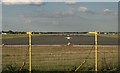
Runway
Runway of London-Southend Airport, looking North-East from Eastwoodbury Lane.
Image: © Paul Collins
Taken: 6 Aug 2007
0.14 miles
2
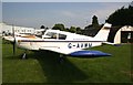
Southend Flying Club
The Building of Southend Flying Club was used in World War Two
Image: © terry joyce
Taken: 7 Jun 2006
0.15 miles
3
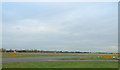
Charlie 1
The two yellow markers either side of the Taxiway indicate a Hold Point. This particular point at Southend Airport is designated Charlie 1. Planes wait at this point to get final permission from Air Traffic Control, to cross the Runway or Take Off.
Charlie 1 is used for Planes taking off on Runway 06.
Image: © terry joyce
Taken: 8 Nov 2007
0.15 miles
4
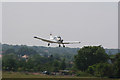
Landing 06, Southend Airport
This is a PA28 Cherokee crossing the threshold of runway 06. The yellow marker posts are either side of Eastwoodbury Lane. At present (November 2010) a bypass is being constructed to allow the runway to be extended over this section of Eastwoodbury Lane.
Image: © terry joyce
Taken: 30 Jun 2009
0.15 miles
5
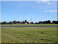
Runway, Southend Airport
The western end of the runway, viewed through the fence by the corner of Eastwood churchyard. Sadly, no planes when I was there.
Image: © Robin Webster
Taken: 1 Oct 2018
0.15 miles
6
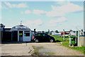
Southend Flying Club
The clubhouse was part of RAF Rochford Airport during the Second World War.
Image: © terry joyce
Taken: 20 Oct 2010
0.16 miles
7
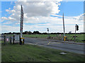
Beware of low flying aircraft
The barriers are closed when large jets come to Southend Airport, as the end of the runway is close to the road.
Image: © william
Taken: 18 Sep 2010
0.19 miles
8
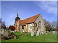
St Laurence, Eastwood
Southend airport keep putting another ridiculous proposal after another in regard to this church which they feel is stopping their 'expansion'. Tough!
Plans have included total demolition and removing the church brick by brick to another location some distance away from the runway (no doubt costing the local council tax payer millions). The lack of regard for heritage in this country is quite sad. I hope the church wins out. It is a thousand years old.
Image: © Julieanne Savage
Taken: 5 Feb 2007
0.22 miles
9
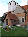
St Laurence church
The church is right next to the end of the runway at Southend Airport.
Image: © william
Taken: 18 Sep 2010
0.22 miles
10

St Laurence Churchyard
A graveyard on the boundary of London Southend Airport.
Image: © John Allan
Taken: 22 Mar 2007
0.22 miles