
IMAGES TAKEN NEAR TO
Ewing Gardens, BASILDON, SS16 5PT
Introduction
This page details the photographs taken nearby to Ewing Gardens, SS16 5PT by members of the Geograph project.
The Geograph project started in 2005 with the aim of publishing, organising and preserving representative images for every square kilometre of Great Britain, Ireland and the Isle of Man.

There are currently over 7.5m images from over14,400 individuals and you can help contribute to the project by visiting https://www.geograph.org.uk
Image Map
Images are licensed for reuse under creativecommons.org/licenses/by-sa/2.0
Notes
- Clicking on the map will re-center to the selected point.
- The higher the marker number, the further away the image location is from the centre of the postcode.
Image Listing (7 Images Found)
Images are licensed for reuse under creativecommons.org/licenses/by-sa/2.0
Image
Details
Distance
1
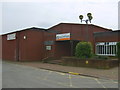
Basildon Sports Centre
A dual use facility used by Thurrock and Basildon College by day.
Image: © William Metcalfe
Taken: 26 Apr 2007
0.08 miles
2
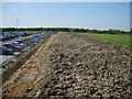
Cars 1 Playing field 0
The result of increased pressure for car parking from the hospital on the left resulted in loss of playing field from Basildon and Thurrock College, which retains only a third of its playing field.
Image: © William Metcalfe
Taken: 19 Apr 2007
0.11 miles
3
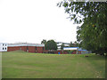
Thurrock & Basildon College
The Basildon campus of this further education college.
Image: © John Winfield
Taken: 23 Sep 2005
0.12 miles
4
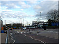
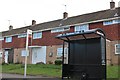
Hospital Bus Stop
This is the Bus Stop and main access road at Basildon Hospital.
Image: © terry joyce
Taken: 10 Jan 2012
0.23 miles
6
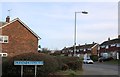
Great Gregorie at the junction of The Knares
Image: © David Howard
Taken: 9 Mar 2019
0.23 miles
7
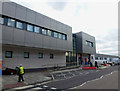
Accident and Emergency
This is the new Accident and Emergency at Basildon Hospital.
Image: © terry joyce
Taken: 10 Jan 2012
0.25 miles