IMAGES TAKEN NEAR TO
Grays Avenue, BASILDON, SS16 5LP
Introduction
This page details the photographs taken nearby to Grays Avenue, SS16 5LP by members of the Geograph project.
The Geograph project started in 2005 with the aim of publishing, organising and preserving representative images for every square kilometre of Great Britain, Ireland and the Isle of Man.

There are currently over 7.5m images from over14,400 individuals and you can help contribute to the project by visiting https://www.geograph.org.uk
Image Map
Images are licensed for reuse under creativecommons.org/licenses/by-sa/2.0
Notes
- Clicking on the map will re-center to the selected point.
- The higher the marker number, the further away the image location is from the centre of the postcode.
Image Listing (5 Images Found)
Images are licensed for reuse under creativecommons.org/licenses/by-sa/2.0
Image
Details
Distance
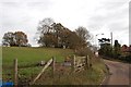
1
Footpath to Old Hill
The path is passing by Great Sutton Wood.
Image: © Trevor Harris
Taken: 11 Oct 2011
0.17 miles
2
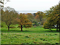
View towards Kent from Langdon Hills
The distant chimney is at Kingsnorth Power Station on the Medway. The much closer blue sign is the name sign for Northlands Approach at its junction with Dry Street.
Image: © Robin Webster
Taken: 13 Nov 2010
0.22 miles
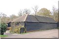
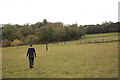
3
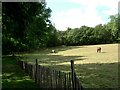
Paddock and Old Hill Wood
The other side of the stile at the end of the fence (which defines the footpath) is a new bridle path not marked on OS maps.
Image: © Glyn Baker
Taken: 1 Oct 2005
0.23 miles