IMAGES TAKEN NEAR TO
London Road, BASILDON, SS16 5LD
Introduction
This page details the photographs taken nearby to London Road, SS16 5LD by members of the Geograph project.
The Geograph project started in 2005 with the aim of publishing, organising and preserving representative images for every square kilometre of Great Britain, Ireland and the Isle of Man.

There are currently over 7.5m images from over14,400 individuals and you can help contribute to the project by visiting https://www.geograph.org.uk
Image Map (Loading...)


Getting Data...Please wait
Leaflet Map data © OpenStreetMap
Images are licensed for reuse under creativecommons.org/licenses/by-sa/2.0
Notes
- Clicking on the map will re-center to the selected point.
- The higher the marker number, the further away the image location is from the centre of the postcode.
Image Listing (19 Images Found)
Images are licensed for reuse under creativecommons.org/licenses/by-sa/2.0
Image
Details
Distance
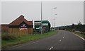
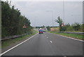
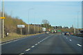
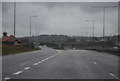
4
London Road Vange
Looking towards Nether Mayne.
Image: © David Howard
Taken: 25 May 2021
0.08 miles
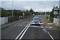
10
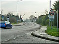
Level Crossing, Vange
The barriers are just descending for a c2c train on the original LTSR route to Southend via Tilbury.
Image: © Robin Webster
Taken: 12 Dec 2013
0.18 miles