IMAGES TAKEN NEAR TO
Leon Drive, BASILDON, SS16 4RJ
Introduction
This page details the photographs taken nearby to Leon Drive, SS16 4RJ by members of the Geograph project.
The Geograph project started in 2005 with the aim of publishing, organising and preserving representative images for every square kilometre of Great Britain, Ireland and the Isle of Man.

There are currently over 7.5m images from over14,400 individuals and you can help contribute to the project by visiting https://www.geograph.org.uk
Image Map
Images are licensed for reuse under creativecommons.org/licenses/by-sa/2.0
Notes
- Clicking on the map will re-center to the selected point.
- The higher the marker number, the further away the image location is from the centre of the postcode.
Image Listing (22 Images Found)
Images are licensed for reuse under creativecommons.org/licenses/by-sa/2.0
Image
Details
Distance
1
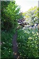
PROW 279_184
This 479m Public Right of Way connects Cashmere Way and Clay Hill Rd.
Image: © Glyn Baker
Taken: 8 May 2020
0.12 miles
3
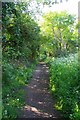
Heading for Basildon Golf Course
A little further up Image
Image: © Glyn Baker
Taken: 8 May 2020
0.18 miles
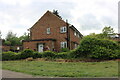
10
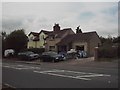
The old school
This is the second Vange village school in London Road before the new school was built for the 1877 Act. Now much extended.
Image: © Bob Rust
Taken: 7 Sep 1998
0.21 miles