IMAGES TAKEN NEAR TO
Woodstock Crescent, BASILDON, SS15 6LG
Introduction
This page details the photographs taken nearby to Woodstock Crescent, SS15 6LG by members of the Geograph project.
The Geograph project started in 2005 with the aim of publishing, organising and preserving representative images for every square kilometre of Great Britain, Ireland and the Isle of Man.

There are currently over 7.5m images from over14,400 individuals and you can help contribute to the project by visiting https://www.geograph.org.uk
Image Map
Images are licensed for reuse under creativecommons.org/licenses/by-sa/2.0
Notes
- Clicking on the map will re-center to the selected point.
- The higher the marker number, the further away the image location is from the centre of the postcode.
Image Listing (13 Images Found)
Images are licensed for reuse under creativecommons.org/licenses/by-sa/2.0
Image
Details
Distance
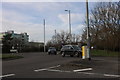
1
Fenton Way at the junction of West Mayne
Image: © David Howard
Taken: 9 Mar 2019
0.09 miles
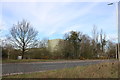
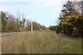
3
West Mayne, Laindon
The view looks west along West Mayne towards the Durham Road roundabout.
Image: © Trevor Harris
Taken: 29 Jan 2009
0.13 miles
4
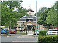
The Four Seasons, Laindon
A 'Hungry Horse' pub, with emphasis on food.
Image: © Robin Webster
Taken: 9 Jul 2015
0.16 miles
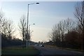
6
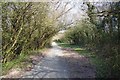
Path Through Devonshire Park
A permissive cycleway
Image: © Glyn Baker
Taken: 27 Mar 2020
0.19 miles
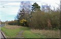
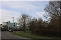
9
Industrial units by West Mayne, Laindon
Image: © David Howard
Taken: 9 Mar 2019
0.22 miles