
IMAGES TAKEN NEAR TO
Barleylands Road, BASILDON, SS15 4BG
Introduction
This page details the photographs taken nearby to Barleylands Road, SS15 4BG by members of the Geograph project.
The Geograph project started in 2005 with the aim of publishing, organising and preserving representative images for every square kilometre of Great Britain, Ireland and the Isle of Man.

There are currently over 7.5m images from over14,400 individuals and you can help contribute to the project by visiting https://www.geograph.org.uk
Image Map
Images are licensed for reuse under creativecommons.org/licenses/by-sa/2.0
Notes
- Clicking on the map will re-center to the selected point.
- The higher the marker number, the further away the image location is from the centre of the postcode.
Image Listing (4 Images Found)
Images are licensed for reuse under creativecommons.org/licenses/by-sa/2.0
Image
Details
Distance
1
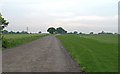
Track and Sports Field, Noak Bridge
Sports field to the right of the picture, and arable land to the left.
Image: © Roger Jones
Taken: 19 May 2019
0.16 miles
2
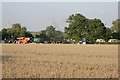
Barleylands Farm - Billericay
Here we see just setting up for the annual country show some threshing machines and traction engines.
Image: © Andrew Pickess
Taken: 8 Sep 2005
0.17 miles
3
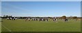
Barleylands Football pitches
By White's Farm, Sunday morning
Image: © Chris Morgan
Taken: 18 Nov 2012
0.22 miles
4
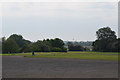
Car park at Barleylands
Looking south east towards Basildon with the "onion" water-tower of the former Ford Tractor Plant in the background.
Image: © Trevor Harris
Taken: 21 May 2018
0.23 miles