IMAGES TAKEN NEAR TO
Craylands, BASILDON, SS14 3RH
Introduction
This page details the photographs taken nearby to Craylands, SS14 3RH by members of the Geograph project.
The Geograph project started in 2005 with the aim of publishing, organising and preserving representative images for every square kilometre of Great Britain, Ireland and the Isle of Man.

There are currently over 7.5m images from over14,400 individuals and you can help contribute to the project by visiting https://www.geograph.org.uk
Image Map
Images are licensed for reuse under creativecommons.org/licenses/by-sa/2.0
Notes
- Clicking on the map will re-center to the selected point.
- The higher the marker number, the further away the image location is from the centre of the postcode.
Image Listing (8 Images Found)
Images are licensed for reuse under creativecommons.org/licenses/by-sa/2.0
Image
Details
Distance
4
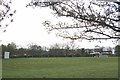
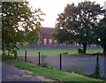
Basildon & Pitsea Cricket Club
This is the home ground for the Basildon & Pitsea Cricket Club http://basildoncricket.hitscricket.com/default.aspx
Image: © Glyn Baker
Taken: 27 Apr 2016
0.16 miles
5
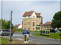
New flats, Basildon
By the Broadmayne - Timberlog Lane roundabout.
Image: © Robin Webster
Taken: 28 May 2017
0.18 miles
6
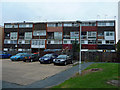
Maisonettes in Fryerns
Basildon's impersonation of 1970s East Germany. The area is scheduled for redevelopment.
Image: © John Allan
Taken: 19 Sep 2011
0.18 miles
7
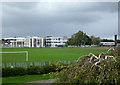
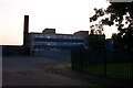
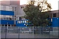
Barstable School
Originally Barstable Grammar School, now the Basildon Lower Academy.
Image: © terry joyce
Taken: 16 Oct 2010
0.22 miles