
IMAGES TAKEN NEAR TO
Downey Close, BASILDON, SS14 2NF
Introduction
This page details the photographs taken nearby to Downey Close, SS14 2NF by members of the Geograph project.
The Geograph project started in 2005 with the aim of publishing, organising and preserving representative images for every square kilometre of Great Britain, Ireland and the Isle of Man.

There are currently over 7.5m images from over14,400 individuals and you can help contribute to the project by visiting https://www.geograph.org.uk
Image Map
Images are licensed for reuse under creativecommons.org/licenses/by-sa/2.0
Notes
- Clicking on the map will re-center to the selected point.
- The higher the marker number, the further away the image location is from the centre of the postcode.
Image Listing (5 Images Found)
Images are licensed for reuse under creativecommons.org/licenses/by-sa/2.0
Image
Details
Distance
1
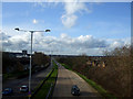
The Mayne View
Taken from the footbridge that crosses this road the A1321 Broadmayne in Basildon, looking towards the Town Centre.
Broadmayne is approximately 1.75 miles and links four of the other 'Maynes', Southmayne, Eastmayne, Uppermayne and Nethermayne.
Image: © terry joyce
Taken: 26 Jan 2012
0.14 miles
2
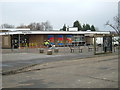
Fryerns Library, Basildon
Behind the Library is a community centre and to the left a parade of shops. The photo was taken looking north across Whitmore Way
Image: © Glyn Baker
Taken: 16 Jan 2006
0.18 miles
3
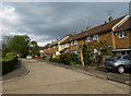
Shortacre
A short cul-de-sac off Methersgate in Ghyllgrove, Basildon.
Image: © John Allan
Taken: 13 May 2013
0.19 miles
4

Shops, Whitmore Way, Basildon
The local shopping centre in Fryerns. As usual flats above shops.
Image: © Stephen Richards
Taken: 23 Jun 2019
0.20 miles
5
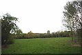
Green Lung in Barstable
Maybe the description is a bit ambitious maybe a green alveoli! !
Image: © Glyn Baker
Taken: 27 Apr 2016
0.22 miles