
IMAGES TAKEN NEAR TO
Rokells, BASILDON, SS14 2BH
Introduction
This page details the photographs taken nearby to Rokells, SS14 2BH by members of the Geograph project.
The Geograph project started in 2005 with the aim of publishing, organising and preserving representative images for every square kilometre of Great Britain, Ireland and the Isle of Man.

There are currently over 7.5m images from over14,400 individuals and you can help contribute to the project by visiting https://www.geograph.org.uk
Image Map
Images are licensed for reuse under creativecommons.org/licenses/by-sa/2.0
Notes
- Clicking on the map will re-center to the selected point.
- The higher the marker number, the further away the image location is from the centre of the postcode.
Image Listing (8 Images Found)
Images are licensed for reuse under creativecommons.org/licenses/by-sa/2.0
Image
Details
Distance
3
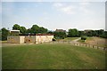
Abandoned Pavilion in Gloucester park
There is no indication as to what purpose this block once served but it is now well boarded up and forlorn.
Image: © Glyn Baker
Taken: 19 May 2011
0.14 miles
4
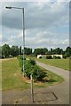
A Path in Gloucester Park
The path leading from the car park in Gloucester Park http://www.basildon.com/history/parks/gp.html
Image: © Glyn Baker
Taken: 19 May 2011
0.14 miles
5
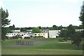
Towards Ghyllgrove
Looking towards the Ghyllgrove area of Basildon across Gloucester park
Image: © Glyn Baker
Taken: 19 May 2011
0.18 miles
6
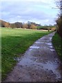
Gloucester Park (6)
MUD-filled path
Image: © Julieanne Savage
Taken: 6 Jan 2007
0.20 miles
7
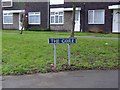
Horror Film Road
Me and my mate Trace were visiting her mum in Butneys. To get there we had to walk through this appropriately named estate.
Image: © Julieanne Savage
Taken: 4 Feb 2007
0.23 miles
8
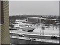
Gloucester Park and swimming pool
A cold day with a sudden heavy snowfall.
Image: © Ron Galliers
Taken: Unknown
0.25 miles