
IMAGES TAKEN NEAR TO
Luncies Road, BASILDON, SS14 1SG
Introduction
This page details the photographs taken nearby to Luncies Road, SS14 1SG by members of the Geograph project.
The Geograph project started in 2005 with the aim of publishing, organising and preserving representative images for every square kilometre of Great Britain, Ireland and the Isle of Man.

There are currently over 7.5m images from over14,400 individuals and you can help contribute to the project by visiting https://www.geograph.org.uk
Image Map
Images are licensed for reuse under creativecommons.org/licenses/by-sa/2.0
Notes
- Clicking on the map will re-center to the selected point.
- The higher the marker number, the further away the image location is from the centre of the postcode.
Image Listing (11 Images Found)
Images are licensed for reuse under creativecommons.org/licenses/by-sa/2.0
Image
Details
Distance
1
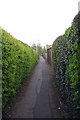
Ivy Path
Where I come from this sort of urban footpath is known as a Folley.
Image: © Glyn Baker
Taken: 27 Apr 2016
0.15 miles
2
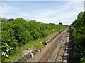
Railway east of Timberlog Lane
The LTSR short-cut route to Southend, completed in 1888, which knocked six miles off the 1856 route via Tilbury and avoided a great many features not helpful for fast running, such as many level crossings, sharp curves and significant freight traffic. This was at the expense of having to cross Langdon Hills. Here the line descends at 1 in 110 to rejoin the old route at Pitsea. This investment was spurred by imminent competition from the Great Eastern branch to Southend, which opened the following year.
Image: © Robin Webster
Taken: 28 May 2017
0.16 miles
3
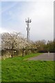
Small Goal & Telecoms Tower
A play area in Barstable.
Image: © Glyn Baker
Taken: 27 Apr 2016
0.18 miles
4
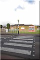
Timberlog Youth Centre
The youth centre in Barstable
Image: © Glyn Baker
Taken: 27 Apr 2016
0.18 miles
5
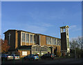
The church of 'St. Basil the Great', Vange
Large Roman Catholic church on the east side of Basildon
Image: © John Winfield
Taken: 9 Dec 2005
0.20 miles
6
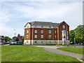
Flats, Basildon
On the corner of Clay Hill Road and Timberlog Lane.
Image: © Robin Webster
Taken: 28 May 2017
0.20 miles
8

The Winged Horse, Luncies Road, Basildon
No New Town local shopping centre is complete without a period pub. This one has a slate-hung upper storey.
Still going in 2026.
Image: © Stephen Richards
Taken: 23 Jun 2019
0.23 miles
9
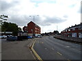
Bus stop and shelter on Clay Hill Road, Basildon
Image: © JThomas
Taken: 23 Aug 2022
0.23 miles
10
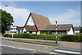
Trinity Methodist Church, Clay Hill Road
Image: © Robin Webster
Taken: 28 May 2017
0.24 miles