
IMAGES TAKEN NEAR TO
Barnstaple Road, SOUTHEND-ON-SEA, SS1 3PN
Introduction
This page details the photographs taken nearby to Barnstaple Road, SS1 3PN by members of the Geograph project.
The Geograph project started in 2005 with the aim of publishing, organising and preserving representative images for every square kilometre of Great Britain, Ireland and the Isle of Man.

There are currently over 7.5m images from over14,400 individuals and you can help contribute to the project by visiting https://www.geograph.org.uk
Image Map
Images are licensed for reuse under creativecommons.org/licenses/by-sa/2.0
Notes
- Clicking on the map will re-center to the selected point.
- The higher the marker number, the further away the image location is from the centre of the postcode.
Image Listing (37 Images Found)
Images are licensed for reuse under creativecommons.org/licenses/by-sa/2.0
Image
Details
Distance
1

Ladram Road, Thorpe Bay
Taken from the junction with Barnstaple Road.
Image: © David Kemp
Taken: 15 Apr 2019
0.05 miles
2
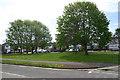
Barnstaple Road, Thorpe Bay
The south side of Barnstaple Road loops round a small green at this point.
Image: © David Kemp
Taken: 30 Apr 2020
0.09 miles
3
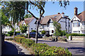
Station Road, Thorpe Bay
Station Road connects Maplin Way with Thorpe Bay station. The houses here with their first floor verandas have an unusual design.
Image: © Stephen McKay
Taken: 11 Aug 2022
0.12 miles
4
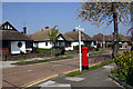
Samuels Drive, Thorpe Bay
Taken from Barnstaple Road.
Image: © David Kemp
Taken: 15 Apr 2019
0.14 miles
5
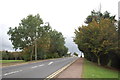
Maplin Way North
Looking up towards the road bridge over the railway line.
Image: © Trevor Harris
Taken: 12 Oct 2014
0.15 miles
6
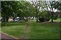
Green at corner of Maplin Way North & Bishopsteignton, Shoeburyness
Image: © David Kemp
Taken: 30 Apr 2020
0.15 miles
7
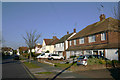
Marcus Avenue, Thorpe Bay
Except at its north end (seen here) Marcus Avenue is almost entirely bungalows.
Image: © David Kemp
Taken: 22 Feb 2018
0.15 miles
8
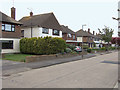
'Goldsworthy' houses in Burlescoombe Road, Thorpe Bay
Houses in the Southend area built in this style are invariably called 'Goldsworthy houses' by estate agents. Why this is and whether the practice is confined to Southend I have no idea.
Image: © David Kemp
Taken: 18 Apr 2014
0.17 miles
9
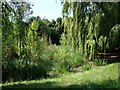
Silted pond
Willow-lined and reed and sedge-choked, a shrinking pond on a small public open space north of the railway line
Image: © John Myers
Taken: 24 Jul 2014
0.18 miles
10
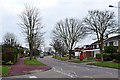
Burlescoombe Road
From Cherrybrook approaching the junction with Maplin Way North
Image: © John Myers
Taken: 22 Jan 2015
0.18 miles