
IMAGES TAKEN NEAR TO
Southchurch Avenue, SOUTHEND-ON-SEA, SS1 2RS
Introduction
This page details the photographs taken nearby to Southchurch Avenue, SS1 2RS by members of the Geograph project.
The Geograph project started in 2005 with the aim of publishing, organising and preserving representative images for every square kilometre of Great Britain, Ireland and the Isle of Man.

There are currently over 7.5m images from over14,400 individuals and you can help contribute to the project by visiting https://www.geograph.org.uk
Image Map
Images are licensed for reuse under creativecommons.org/licenses/by-sa/2.0
Notes
- Clicking on the map will re-center to the selected point.
- The higher the marker number, the further away the image location is from the centre of the postcode.
Image Listing (60 Images Found)
Images are licensed for reuse under creativecommons.org/licenses/by-sa/2.0
Image
Details
Distance
1
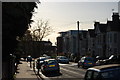
Honiton Road, Southchurch
A view down Honiton Road with the dome of the Kursaal in the background.
Image: © Trevor Harris
Taken: 30 Nov 2011
0.06 miles
2
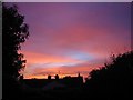
Sunset over Southend town centre
This was taken from my back garden.
Image: © lesley fowler
Taken: 5 Nov 2006
0.08 miles
3
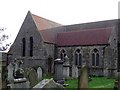
St. John's
This centralised church has been targeted for "development" as part of the Pier / Palace Hotel refurbishments. It stands next to the Palace Hotel.
http://www.echo-news.co.uk/display.var.1096397.0.revamp_shows_off_church_treasures.php
Image: © Julieanne Savage
Taken: 12 Jan 2007
0.09 miles
4
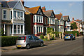
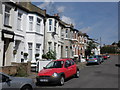
York Road, Southchurch
This part of York Road - between Honiton Road and Cheltenham Road - was built at the turn of the C19/C20 with fairly large semi-detached properties such as these, many of which are now multi-occupied. Before its connection with Southend High Street was severed several decades ago, York Road was a busy through route between Southend and Thorpe Bay and enjoyed a frequent bus service.
Image: © David Kemp
Taken: 8 Aug 2013
0.11 miles
6
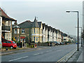
Turreted house on Woodgrange Drive
A turret for the house on the corner is not an uncommon feature of housing development of this sort of age.
Image: © Robin Webster
Taken: 12 Dec 2013
0.13 miles
7
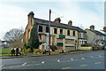
Derelict houses, Southchurch Avenue, Southend, 2013
Now demolished, and being redeveloped along with the then empty site to the left.
Image: © Robin Webster
Taken: 12 Dec 2013
0.13 miles
8
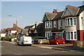
York Road, Southchurch
The further east you go along York Road, the newer the houses become. The two semis nearest the camera date from around the time of the First World War and those beyond from a bit later. The mixture of semis and bungalows in the same block seems very characteristic of the C20 development of Southend. This shot was taken between Cheltenham Road and Leamington Road.
Image: © David Kemp
Taken: 8 Aug 2013
0.14 miles
9
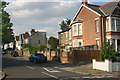
North-east corner of York Road & Cheltenham Road, Southchurch
Taken from York Road looking up Cheltenham Road.
Image: © David Kemp
Taken: 8 Aug 2013
0.14 miles
10
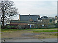
Burnt out industrial premises, Southend, 2013
A rear view of premises on Pleasant Road. Remarkably the buildings survive in 2022 views, but apparently disused and certainly boarded up to the street.
Image: © Robin Webster
Taken: 12 Dec 2013
0.18 miles