IMAGES TAKEN NEAR TO
Melville Drive, WICKFORD, SS12 9FE
Introduction
This page details the photographs taken nearby to Melville Drive, SS12 9FE by members of the Geograph project.
The Geograph project started in 2005 with the aim of publishing, organising and preserving representative images for every square kilometre of Great Britain, Ireland and the Isle of Man.

There are currently over 7.5m images from over14,400 individuals and you can help contribute to the project by visiting https://www.geograph.org.uk
Image Map
Images are licensed for reuse under creativecommons.org/licenses/by-sa/2.0
Notes
- Clicking on the map will re-center to the selected point.
- The higher the marker number, the further away the image location is from the centre of the postcode.
Image Listing (13 Images Found)
Images are licensed for reuse under creativecommons.org/licenses/by-sa/2.0
Image
Details
Distance
1
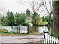
Great Broomfields
Is a Grade II listed building in Cranfield Park Road.
Image: © terry joyce
Taken: 22 Nov 2010
0.11 miles
2
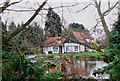
Great Broomfields
A better view of the sixteenth/seventeenth century grade II listed house.
Image: © terry joyce
Taken: 22 Nov 2010
0.11 miles
4
Park with no name
I couldn't find a name plaque for this park, but as it is in Cranfield Park Way, I would assume it's Cranfield Park. The car park is small and unmade with quite big potholes.
Image: © terry joyce
Taken: 22 Nov 2010
0.16 miles
5
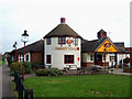
Darby Digger
Public House is accessed from Radwinter Avenue.
Image: © terry joyce
Taken: 22 Nov 2010
0.21 miles
7
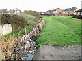
Wickford Stream
This is next to the Image Pub.
It appears from three large culverts. It joins the River Crouch near the roundabout where the A132, joins the A129.
Image: © terry joyce
Taken: 22 Nov 2010
0.22 miles
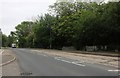
8
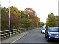
Maitland Road
This is Maitland Road. The trees on the left are the edge of a small wood called The Oaks. It is about 170 metres by 50 metres.
Image: © terry joyce
Taken: 22 Nov 2010
0.22 miles
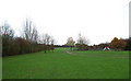
9
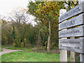
The Oaks
This is a small wood called The Oaks. It is about 170 metres by 50 metres.
Access from Scott Drive or a cycle path at the east side of the wood.
Image: © terry joyce
Taken: 22 Nov 2010
0.23 miles
10
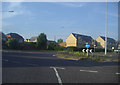
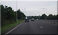
Roundabout on Cranfield Park Road, Wickford
More typical Essex neo-feudal workmens' cottages.
Image: © David Howard
Taken: 20 Jun 2012
0.23 miles