IMAGES TAKEN NEAR TO
Bromfords Drive, WICKFORD, SS12 0NZ
Introduction
This page details the photographs taken nearby to Bromfords Drive, SS12 0NZ by members of the Geograph project.
The Geograph project started in 2005 with the aim of publishing, organising and preserving representative images for every square kilometre of Great Britain, Ireland and the Isle of Man.

There are currently over 7.5m images from over14,400 individuals and you can help contribute to the project by visiting https://www.geograph.org.uk
Image Map
Images are licensed for reuse under creativecommons.org/licenses/by-sa/2.0
Notes
- Clicking on the map will re-center to the selected point.
- The higher the marker number, the further away the image location is from the centre of the postcode.
Image Listing (5 Images Found)
Images are licensed for reuse under creativecommons.org/licenses/by-sa/2.0
Image
Details
Distance
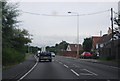
1
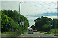
A132 - pedestrian and cycle crossing, Wickford
The plethora of posts and poles rather reduces the sighting time for the direction sign beyond.
Image: © Robin Webster
Taken: 22 Jul 2012
0.21 miles
3
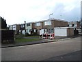
Thackeray Row, Wickford
These flat roofed early 1970’s(?) houses are in Thackeray Row, Wickford.
Image: © Glyn Baker
Taken: 24 Feb 2006
0.22 miles
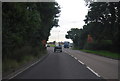
5
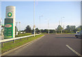
Roundabout on Golden Jubilee Way, Wickford
Image: © David Howard
Taken: 20 Jun 2012
0.24 miles