
IMAGES TAKEN NEAR TO
London Road, WICKFORD, SS12 0LF
Introduction
This page details the photographs taken nearby to London Road, SS12 0LF by members of the Geograph project.
The Geograph project started in 2005 with the aim of publishing, organising and preserving representative images for every square kilometre of Great Britain, Ireland and the Isle of Man.

There are currently over 7.5m images from over14,400 individuals and you can help contribute to the project by visiting https://www.geograph.org.uk
Image Map
Images are licensed for reuse under creativecommons.org/licenses/by-sa/2.0
Notes
- Clicking on the map will re-center to the selected point.
- The higher the marker number, the further away the image location is from the centre of the postcode.
Image Listing (6 Images Found)
Images are licensed for reuse under creativecommons.org/licenses/by-sa/2.0
Image
Details
Distance
1
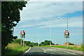
From a 30 to a 40 limit on London Road
A fairly new restriction on the A129 for those travelling the other way, towards Wickford - formerly the 40 limit continued a considerable way further into town.
Image: © Robin Webster
Taken: 22 Jul 2012
0.11 miles
2
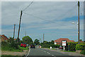
A129 London Road by Eileen's Florist
Not the obvious way to go to London from Wickford these days, but before the Southend Arterial Road was built, you had to go via Billericay and Brentwood.
Image: © Robin Webster
Taken: 22 Jul 2012
0.12 miles
6
Church Road, Crays Hill
Approaching the junction with the A129 London Road near Woolshot's Farm
Image: © Geographer
Taken: 5 Sep 2015
0.25 miles