IMAGES TAKEN NEAR TO
Second Avenue, WICKFORD, SS11 8RD
Introduction
This page details the photographs taken nearby to Second Avenue, SS11 8RD by members of the Geograph project.
The Geograph project started in 2005 with the aim of publishing, organising and preserving representative images for every square kilometre of Great Britain, Ireland and the Isle of Man.

There are currently over 7.5m images from over14,400 individuals and you can help contribute to the project by visiting https://www.geograph.org.uk
Image Map (Loading...)


Getting Data...Please wait
Leaflet Map data © OpenStreetMap
Images are licensed for reuse under creativecommons.org/licenses/by-sa/2.0
Notes
- Clicking on the map will re-center to the selected point.
- The higher the marker number, the further away the image location is from the centre of the postcode.
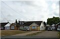
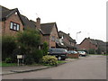
Image Listing (6 Images Found)
Images are licensed for reuse under creativecommons.org/licenses/by-sa/2.0
Image
Details
Distance
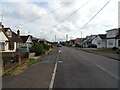
5
Wickford Business Park
That is what the sign reads on the right of the picture. This is Hodgson Way leading onto the industrial estate, although there is quite a lot of houses too.
Image: © terry joyce
Taken: 22 Nov 2010
0.24 miles
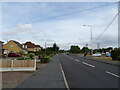
6
A129 Southend Road, Shotgate
Shotgate is now effectively an outlier of Wickford.
Image: © Robin Webster
Taken: 5 Feb 2023
0.25 miles