
IMAGES TAKEN NEAR TO
Fresson Close, SS11 7NF
Introduction
This page details the photographs taken nearby to Fresson Close, SS11 7NF by members of the Geograph project.
The Geograph project started in 2005 with the aim of publishing, organising and preserving representative images for every square kilometre of Great Britain, Ireland and the Isle of Man.

There are currently over 7.5m images from over14,400 individuals and you can help contribute to the project by visiting https://www.geograph.org.uk
Image Map
Images are licensed for reuse under creativecommons.org/licenses/by-sa/2.0
Notes
- Clicking on the map will re-center to the selected point.
- The higher the marker number, the further away the image location is from the centre of the postcode.
Image Listing (5 Images Found)
Images are licensed for reuse under creativecommons.org/licenses/by-sa/2.0
Image
Details
Distance
1
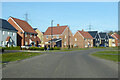
St. Luke's Way, Runwell
A fairly new development on the site of Runwell mental hospital.
Image: © Robin Webster
Taken: 5 Feb 2023
0.11 miles
2
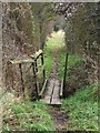
Footpath to Runwell
This footbridge is on a footpath that runs from Warren Rd to the A132 Runwell Rd. The photo was taken looking south
Image: © Glyn Baker
Taken: 18 Feb 2006
0.14 miles
3
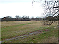
Hospital Fields
This field is part of the Runwell Hospital grounds.
Image: © terry joyce
Taken: 28 Dec 2011
0.19 miles
4
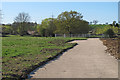
Construction site, former Runwell Hospital
Planning permission has been granted to develop a new residential area on parts of the former Runwell Hospital Site. Here you can see a new road surface which has been recently laid.
see also: Image]
Image: © Roger Jones
Taken: 18 Apr 2015
0.23 miles
5
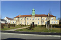
Block with clock tower, former Runwell Hospital
A surviving building at the mental hospital site, which has been redeveloped with a large housing estate, Runwell Park.
Image: © Robin Webster
Taken: 5 Feb 2023
0.25 miles