
IMAGES TAKEN NEAR TO
Windsor Gardens, WICKFORD, SS11 7BP
Introduction
This page details the photographs taken nearby to Windsor Gardens, SS11 7BP by members of the Geograph project.
The Geograph project started in 2005 with the aim of publishing, organising and preserving representative images for every square kilometre of Great Britain, Ireland and the Isle of Man.

There are currently over 7.5m images from over14,400 individuals and you can help contribute to the project by visiting https://www.geograph.org.uk
Image Map
Images are licensed for reuse under creativecommons.org/licenses/by-sa/2.0
Notes
- Clicking on the map will re-center to the selected point.
- The higher the marker number, the further away the image location is from the centre of the postcode.
Image Listing (8 Images Found)
Images are licensed for reuse under creativecommons.org/licenses/by-sa/2.0
Image
Details
Distance
1
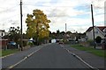
Ethelred Gardens, Runwell
The tower and spire of St Mary's Church can be seen in the distance.
Image: © Trevor Harris
Taken: 20 Oct 2014
0.05 miles
3
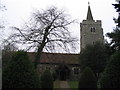
St. Mary's Church, Runwell
Majority of the church was built in the 15th century
Image: © Angela Tuff
Taken: 23 Jan 2006
0.22 miles
5
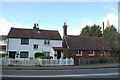
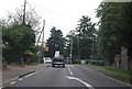
Church Cottages, Runwell
To the right of the white painted Church Cottages is the Old School House. Taken from the edge of St Mary's churchyard.
Image: © Trevor Harris
Taken: 20 Oct 2014
0.23 miles
6
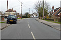
Church End Lane, Runwell
Just really a suburb of Wickford.
Image: © Robin Webster
Taken: 25 Mar 2018
0.24 miles
7

Quick Fix Garage on Runwell Road, Wickford
Image: © David Howard
Taken: 13 Apr 2025
0.24 miles
8
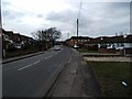
Church End Lane
This is Church End Lane Runwell. The photo was taken looking eastward towards Brock Hill.
Image: © Glyn Baker
Taken: 18 Feb 2006
0.25 miles