
IMAGES TAKEN NEAR TO
Ramuz Drive, WESTCLIFF-ON-SEA, SS0 9JH
Introduction
This page details the photographs taken nearby to Ramuz Drive, SS0 9JH by members of the Geograph project.
The Geograph project started in 2005 with the aim of publishing, organising and preserving representative images for every square kilometre of Great Britain, Ireland and the Isle of Man.

There are currently over 7.5m images from over14,400 individuals and you can help contribute to the project by visiting https://www.geograph.org.uk
Image Map
Images are licensed for reuse under creativecommons.org/licenses/by-sa/2.0
Notes
- Clicking on the map will re-center to the selected point.
- The higher the marker number, the further away the image location is from the centre of the postcode.
Image Listing (11 Images Found)
Images are licensed for reuse under creativecommons.org/licenses/by-sa/2.0
Image
Details
Distance
1
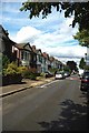
Brightwell Rd Westcliff
Just one of many streets of substantial (Edwardian?) Villas in this area.
Image: © Glyn Baker
Taken: 13 Aug 2011
0.13 miles
2
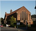
St, Andrews Church
St. Andrews Church, Corner of Westborough Road and Electric Avenue
Image: © Paul Collins
Taken: 31 Jul 2007
0.20 miles
3
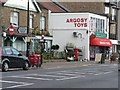
Westcliff-on-Sea: London Road 553 Post Office, and postbox № SS0 115
The name of the post office includes the street number to distinguish it from two other branches in London Road – at 1627 (closed a few years ago) and 1761 – both postally in Leigh-on-Sea rather than Westcliff as here.
This branch will close permanently on 23 September 2008; according to a notice inside, it will not affect the toy shop that it is within.
According to the Royal Mail's postbox list, the box is outside 555 London Road Post Office, which was indeed the case: the office opened in 1924 at 555 Londond Road (outside which the postbox still stands) and moved within the toy shop next door on 10 September 1986.
Image: © Chris Downer
Taken: 18 Sep 2008
0.20 miles
4
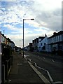
Fairfax Drive
Looking east from the junction with the footpath to the hospital
Image: © John Myers
Taken: 10 Oct 2014
0.21 miles
5
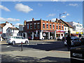
Cheap Appliances, London Road, Westcliff
They don't appear to mean the surgical sort.
Image: © Robin Webster
Taken: 1 Oct 2018
0.21 miles
6
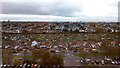
Westcliff-on-Sea from Southend University Hospital 20191101_150346
The view looking SSE from the Tower Block of Southend University Hospital. The houses and allotments visible are in Westcliff-on-Sea which is part of the Borough of Southend-on-Sea in Essex. The Thames Estuary is just visible.
Image: © Trevor Durritt
Taken: 1 Nov 2019
0.22 miles
7
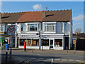
O'Dare's Antique Shop
A shop full of fascinating stuff on Fairfax Drive.
Image: © John Allan
Taken: 16 Apr 2013
0.23 miles
8
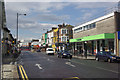
London Road, Westcliff on Sea
Leading out to the west of Southend the A13 is built up for many miles, lined with businesses of all kinds; this is the busy stretch through Westcliff on Sea.
Image: © Stephen McKay
Taken: 27 Aug 2011
0.23 miles
9
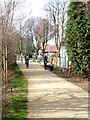
Prittle Brook Greenway
This is a section of the Greenway, a Cycle/Footpath that runs alongside Prittle Brook from near Belfairs to Priory Park in Southend.
Image: © terry joyce
Taken: 25 Feb 2012
0.23 miles
10
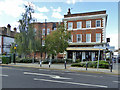
The Trading Room, Westcliff
Pub, formerly a bank.
Image: © Robin Webster
Taken: 1 Oct 2018
0.23 miles