1
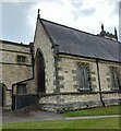
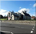
Seaham, St John's parish church
Wider view showing location of benchmark - 1914 OS map indicates 98ft above sea level.
Image: © Mel Towler
Taken: 15 May 2021
0.01 miles
2
Seaham, St John's parish church
Benchmark on stonework. OS 1914 map says 98ft above sea level.
Image: © Mel Towler
Taken: 15 May 2021
0.01 miles
3
Church Street, Seaham
Pedestrianised street leading from the Harbour up to St John's Parish Church.
Image: © Oliver Dixon
Taken: 10 Feb 2016
0.03 miles
4
Ordnance Survey Cut Mark
This OS cut mark can be found on the north face of St John's Church. It marks a point 29.608m above mean sea level.
Image: © Adrian Dust
Taken: 19 Sep 2018
0.03 miles
5
Church of St John the Evangelist
The parish Church of Seaham, grade 2 listed, dating from 1835-40 with more recent additions.
Image: © Oliver Dixon
Taken: 10 Feb 2016
0.03 miles
6
Seaham Parish Church, St John the Evangelist
Image: © Colin Pyle
Taken: 3 Nov 2015
0.03 miles
7
Parish Church of St John the Evangelist, Seaham
The Grade II listed https://historicengland.org.uk/listing/the-list/list-entry/1277262?section=official-list-entry church by Thomas Prosser dates from 1840. The north aisle was added in 1860 and the choir and vicar's vestries were added by R.J.Johnson in 1885-6.
An historic timeline can be found on the church website: https://stjohns-seaham.org.uk/church-history
Image: © Gerald England
Taken: 18 Oct 2022
0.04 miles
8
Parish Church of St John the Evangelist, Seaham
The Grade II listed https://historicengland.org.uk/listing/the-list/list-entry/1277262?section=official-list-entry church by Thomas Prosser dates from 1840. The north aisle was added in 1860 and the choir and vicar's vestries were added by R.J.Johnson in 1885-6.
An historic timeline can be found on the church website: https://stjohns-seaham.org.uk/church-history
Image: © Gerald England
Taken: 18 Oct 2022
0.04 miles
9
Parish Church of St.John's, New Seaham
Built in 1857 due to the rapid expansion of New Seaham and the inability of the old Church of St.Mary's to be able to cope with all the extra burials.
To give some idea of this, the parish census for Seaham in 1841 was 153, by 1851 it was at 729, by 1861 it was an incredible 2591, and by 1891 it was close to 4800 souls.
Image: © Matthew Hatton
Taken: 16 Jan 2016
0.04 miles
10
Church of St John the Evangelist
The church as seen from the south over a grassed field which once was the graveyard but the monuments have been removed due to instability and are arranged around and against the perimeter wall.
Image: © Trevor Littlewood
Taken: 14 Feb 2019
0.04 miles


