IMAGES TAKEN NEAR TO
Laura Street, SEAHAM, SR7 7HS
Introduction
This page details the photographs taken nearby to Laura Street, SR7 7HS by members of the Geograph project.
The Geograph project started in 2005 with the aim of publishing, organising and preserving representative images for every square kilometre of Great Britain, Ireland and the Isle of Man.

There are currently over 7.5m images from over14,400 individuals and you can help contribute to the project by visiting https://www.geograph.org.uk
Image Map
Images are licensed for reuse under creativecommons.org/licenses/by-sa/2.0
Notes
- Clicking on the map will re-center to the selected point.
- The higher the marker number, the further away the image location is from the centre of the postcode.
Image Listing (32 Images Found)
Images are licensed for reuse under creativecommons.org/licenses/by-sa/2.0
Image
Details
Distance
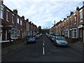
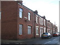
5
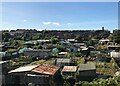
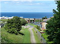
Allotments At Dawdon
Allotment gardens in front of colliery rows at Dawdon. Dawdon Colliery was one of the last to close in the Durham coalfield.
Image: © David Robinson
Taken: 20 Sep 2021
0.09 miles
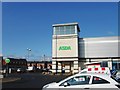
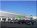
10
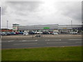
Seaham - Asda Supermarket
Part of a new shopping complex.
Image: © James Emmans
Taken: 14 Apr 2017
0.20 miles