
IMAGES TAKEN NEAR TO
Moray Street, SUNDERLAND, SR6 9RR
Introduction
This page details the photographs taken nearby to Moray Street, SR6 9RR by members of the Geograph project.
The Geograph project started in 2005 with the aim of publishing, organising and preserving representative images for every square kilometre of Great Britain, Ireland and the Isle of Man.

There are currently over 7.5m images from over14,400 individuals and you can help contribute to the project by visiting https://www.geograph.org.uk
Image Map
Images are licensed for reuse under creativecommons.org/licenses/by-sa/2.0
Notes
- Clicking on the map will re-center to the selected point.
- The higher the marker number, the further away the image location is from the centre of the postcode.
Image Listing (6 Images Found)
Images are licensed for reuse under creativecommons.org/licenses/by-sa/2.0
Image
Details
Distance
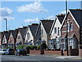
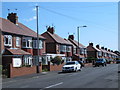
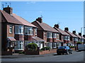
4

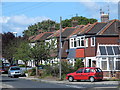
Mill View Avenue, Fulwell, Sunderland
Mill View Avenue is a residential cul-de-sac in Fulwell, to the north of Sunderland.
Image: © Malc McDonald
Taken: 4 Apr 2015
0.22 miles
6
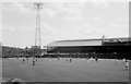
Roker Park August 1976
This is Sunderland about to kick off over 30 years ago against Arsenal. The Roker End to the left is uncovered and the stand opposite was known as the Clock Stand. If you look carefully you can see the Match of The Day cameras on top of the stand.
The ground is now gone and has a housing estate built on it now. I think there maybe a Clock Stand Drive. There is also a Goalmouth Close and of course the aptly named Promotion Close. Happy Days.
Image: © John Harvey
Taken: Unknown
0.23 miles