IMAGES TAKEN NEAR TO
Maple Grove, SUNDERLAND, SR6 7AP
Introduction
This page details the photographs taken nearby to Maple Grove, SR6 7AP by members of the Geograph project.
The Geograph project started in 2005 with the aim of publishing, organising and preserving representative images for every square kilometre of Great Britain, Ireland and the Isle of Man.

There are currently over 7.5m images from over14,400 individuals and you can help contribute to the project by visiting https://www.geograph.org.uk
Image Map
Images are licensed for reuse under creativecommons.org/licenses/by-sa/2.0
Notes
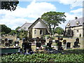
- Clicking on the map will re-center to the selected point.
- The higher the marker number, the further away the image location is from the centre of the postcode.
Image Listing (40 Images Found)
Images are licensed for reuse under creativecommons.org/licenses/by-sa/2.0
Image
Details
Distance
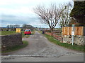
1

Parry Drive Whitburn
Situated in the west of Whitburn, South Tyneside
Image: © Peter Robinson
Taken: 15 Nov 2009
0.10 miles
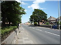
3
National Cycle Network route 1 through Whitburn
For most of the distance between Sunderland and South Shields, National Cycle Network route 1 follows a segregated cycle track on the east side of the A183. But see Image
Image: © Oliver Dixon
Taken: 19 Apr 2016
0.13 miles
4
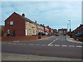
Parry Drive, Whitburn
Parry Drive in the village of Whitburn, in South Tyneside.
Image: © Malc McDonald
Taken: 4 Apr 2015
0.14 miles
5
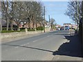
Mill Lane, Whitburn
Looking north on the A183.
Image: © JThomas
Taken: 7 Jul 2018
0.14 miles
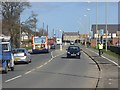
7
The Main Road through Whitburn
For most of the distance between Sunderland and South Shields, National Cycle Network route 1 follows a segregated cycle track on the east side of the A183. But for a 100 metre stretch at the southern end of Whitburn, cyclists are obliged to use the carriageway, requiring (if travelling south to north) two crossings of the busy main road.
Image: © Oliver Dixon
Taken: 19 Apr 2016
0.16 miles
8
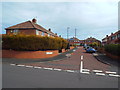
Wellands Lane, Whitburn
Wellands lane in the village of Whitburn, in South Tyneside.
Image: © Malc McDonald
Taken: 4 Apr 2015
0.16 miles
9
Public footpath at Whitburn
A public footpath leading out of the village of Whitburn, in South Tyneside.
Image: © Malc McDonald
Taken: 4 Apr 2015
0.16 miles