IMAGES TAKEN NEAR TO
SUNDERLAND, SR5 9NJ

Introduction

This page details the photographs taken nearby to SR5 9NJ by members of the Geograph project.

The Geograph project started in 2005 with the aim of publishing, organising and preserving representative images for every square kilometre of Great Britain, Ireland and the Isle of Man.

There are currently over 7.5m images from over14,400 individuals and you can help contribute to the project by visiting https://www.geograph.org.uk

Image Map


Images are licensed for reuse under creativecommons.org/licenses/by-sa/2.0
Notes
  • Clicking on the map will re-center to the selected point.
  • The higher the marker number, the further away the image location is from the centre of the postcode.

Image Listing (40 Images Found)

Images are licensed for reuse under creativecommons.org/licenses/by-sa/2.0
  • ...
Image
Details
Distance
1
Sunderland Enterprise Park East
The area seen in the photo used to be a shipbuilding slipway in the Austin and Pickersgill Shipyard until the yard was closed in 1988 (the river Wear is behind the photographer). The yard was subsequently demolished and converted into an 'Enterprise Park' (office / light factory space for small businesses) which is what you see in the photo.
Image: © Brian Abbott Taken: 19 May 2006
0.04 miles
2
The C2C approaching Sunderland
The world famous cycle route which runs from the Irish Sea in West Cumbria to the North Sea at Sunderland.
Image: © Oliver Dixon Taken: 19 Jun 2015
0.06 miles
3
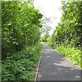
Hylton, Southwick and Monk Wearmouth branch
Rails to trails conversion now part of Route 7 of the National Cycle Network. Between here and the river was once an industrial area of mines and shipyards.
Image: © Richard Webb Taken: 18 Jun 2013
0.09 miles
4
Sculpture beside the C2C
This cast concrete sculpture stands beside the world-famous C2C cycle route near the north bank of the River Wear. It almost certainly graced the River Wear Trail which predated the establishment of the C2C.
Image: © Oliver Dixon Taken: 19 Jun 2015
0.10 miles
5
Sculpture beside the C2C
This cast concrete sculpture stands beside the world-famous C2C cycle route near the north bank of the River Wear. It almost certainly graced the River Wear Trail which predated the establishment of the C2C.
Image: © Oliver Dixon Taken: 19 Jun 2015
0.14 miles
6
View downstream from the Northern Spire Bridge
The River Wear winds under the Queen Alexandra Bridge and past the Stadium of Light, home of Sunderland AFC.
Image: © Russel Wills Taken: 17 Jan 2019
0.15 miles
7
Sunderland from the air
The River Wear is the most prominent feature. Viewed from an Amsterdam bound flight from Glasgow.
Image: © Thomas Nugent Taken: 2 Mar 2015
0.18 miles
8
Riverside Road
Looking east along Riverside Road, home to much light industry.
Image: © Weston Beggard Taken: 4 Dec 2005
0.18 miles
9
Devere Building
One of the many industrial concerns clustered around the Riverside Road area.
Image: © Weston Beggard Taken: 4 Dec 2005
0.18 miles
10
Pop Factory
This is where they make the locally famous Villa range of pops. Ironically some local japesters lobbed a half-full can of Barr's Irn-Bru at us from their speeding 4X4 just prior to us finding this factory.
Image: © MSX Taken: 4 Dec 2005
0.18 miles
  • ...