IMAGES TAKEN NEAR TO
Ealing Square, SUNDERLAND, SR5 2RB
Introduction
This page details the photographs taken nearby to Ealing Square, SR5 2RB by members of the Geograph project.
The Geograph project started in 2005 with the aim of publishing, organising and preserving representative images for every square kilometre of Great Britain, Ireland and the Isle of Man.

There are currently over 7.5m images from over14,400 individuals and you can help contribute to the project by visiting https://www.geograph.org.uk
Image Map
Images are licensed for reuse under creativecommons.org/licenses/by-sa/2.0
Notes
- Clicking on the map will re-center to the selected point.
- The higher the marker number, the further away the image location is from the centre of the postcode.
Image Listing (13 Images Found)
Images are licensed for reuse under creativecommons.org/licenses/by-sa/2.0
Image
Details
Distance
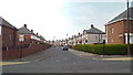
1
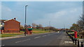
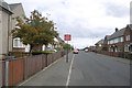
Emsworth Road, Carley Hill, Sunderland
Emsworth Road in Carley Hill, a suburb of Sunderland.
Image: © Malc McDonald
Taken: 20 Apr 2014
0.09 miles
2
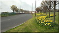
Old Mill Road, Sunderland
The daffodils along the side of the road are a sign that this image was taken in April.
Image: © Malc McDonald
Taken: 20 Apr 2014
0.10 miles
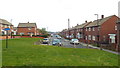
3
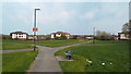
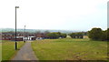
Recreation ground at Carley Hill, Sunderland
Image: © Malc McDonald
Taken: 20 Apr 2014
0.10 miles
4
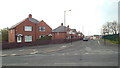
Marley Crescent, Sunderland
Marley Crescent in Marley Pots, a district in Sunderland.
Image: © Malc McDonald
Taken: 20 Apr 2014
0.12 miles
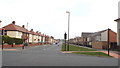
5
Chestnut Crescent, Sunderland
Chestnut Crescent in Marley Pots, a district in Sunderland.
Image: © Malc McDonald
Taken: 20 Apr 2014
0.15 miles
7
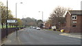
Wembley Road, Witherwack, Sunderland
Wembley Road in Witherwack, a housing area on the northern edge of Sunderland. Road names in Witherwack all begin with "W".
Image: © Malc McDonald
Taken: 20 Apr 2014
0.17 miles
10
Path at Witherwack, Sunderland
Witherwack is a suburb on the northern edge of Sunderland.
Image: © Malc McDonald
Taken: 20 Apr 2014
0.23 miles